
MyTopo
Paulding Michigan US Topo Map
Couldn't load pickup availability
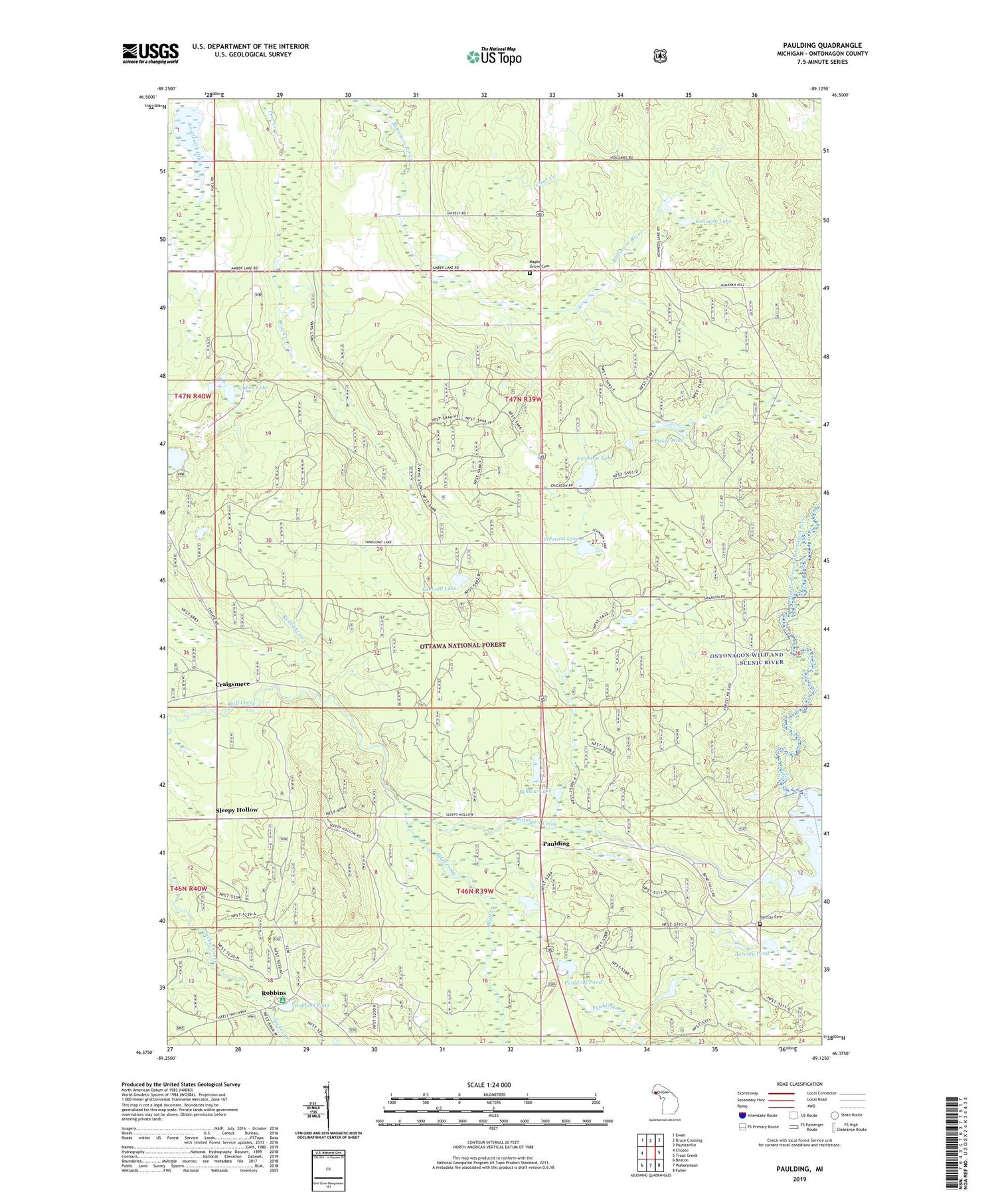
2019 topographic map quadrangle Paulding in the state of Michigan. Scale: 1:24000. Based on the newly updated USGS 7.5' US Topo map series, this map is in the following counties: Ontonagon. The map contains contour data, water features, and other items you are used to seeing on USGS maps, but also has updated roads and other features. This is the next generation of topographic maps. Printed on high-quality waterproof paper with UV fade-resistant inks.
Quads adjacent to this one:
West: Choate
Northwest: Ewen
North: Bruce Crossing
Northeast: Paynesville
East: Trout Creek
Southeast: Fuller
South: Watersmeet
Southwest: Beaton
Contains the following named places: Amber Lake, Barclay Cemetery, Barclay Pond, Behlow Lake, Bond Falls, Bond Falls Park Picnic Area, Craigsmere, Erickson Lake, Johnson Lake, Kennedy Lake, Maple Grove Cemetery, Maple Grove Park, Maple Grove School, Ottawa National Forest, Paulding, Paulding Creek, Paulding Pond, Paulding Pond Campground and Picnic Area, Paulding Post Office, Paulding Station, Pickle Pond, Robbins, Robbins Pond, Robbins Pond Campground, Robbins Post Office, Roselawn Creek, Sleepy Hollow, Steusser Lake Picnic Area, Tanlund Lake, Tanlund Lake Picnic Area, Township of Haight, ZIP Code: 49912


