MyTopo
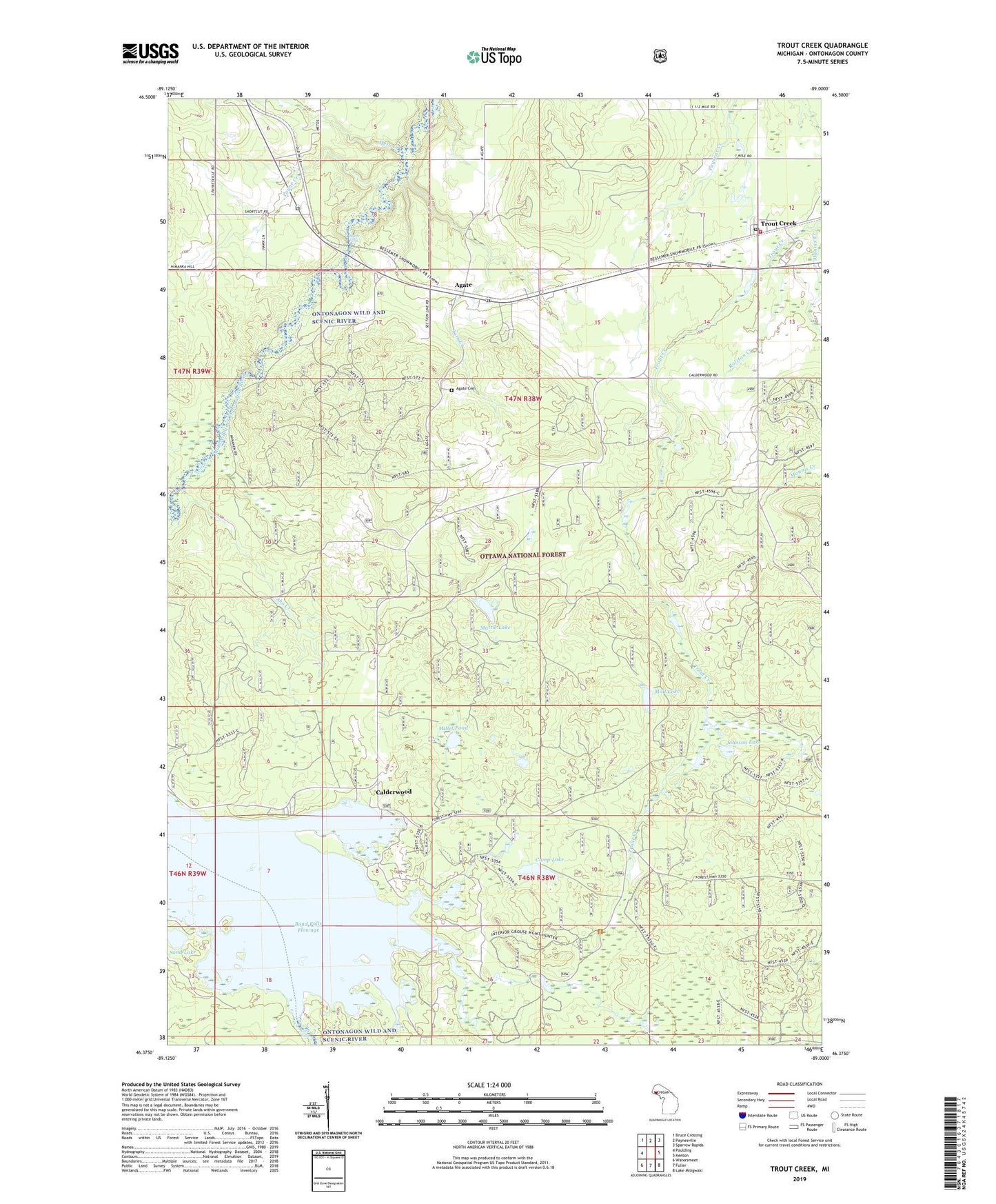
Trout Creek Michigan US Topo Map
Couldn't load pickup availability
Also explore the Trout Creek Forest Service Topo of this same quad for updated USFS data
2023 topographic map quadrangle Trout Creek in the state of Michigan. Scale: 1:24000. Based on the newly updated USGS 7.5' US Topo map series, this map is in the following counties: Ontonagon. The map contains contour data, water features, and other items you are used to seeing on USGS maps, but also has updated roads and other features. This is the next generation of topographic maps. Printed on high-quality waterproof paper with UV fade-resistant inks.
Quads adjacent to this one:
West: Paulding
Northwest: Bruce Crossing
North: Paynesville
Northeast: Sparrow Rapids
East: Kenton
Southeast: Lake Mitigwaki
South: Fuller
Southwest: Watersmeet
This map covers the same area as the classic USGS quad with code o46089d1.
Contains the following named places: Agate, Agate Cemetery, Agate Church, Agate Falls, Agate Post Office, Aho Creek, Bond Falls Flowage, Calderwood, Calderwood Post Office, Calvary Temple Assembly of God Church, Camp Lake, Deadman Creek, Gospel Mission Church, Johnson Lake, Little Falls, Mannis Creek, Mattie Lake, Meto Creek, Millet Pond, Moll Lake, Ontonagon Wild and Scenic River, Payne Creek, Rolston Creek, Sand Lake, Tom Creek, Township of Interior, Trinity Lutheran Church, Trout Creek, Trout Creek Post Office, Trout Creek Station, Trout Creek Township Park, Trout Creek Volunteer Fire Department