MyTopo
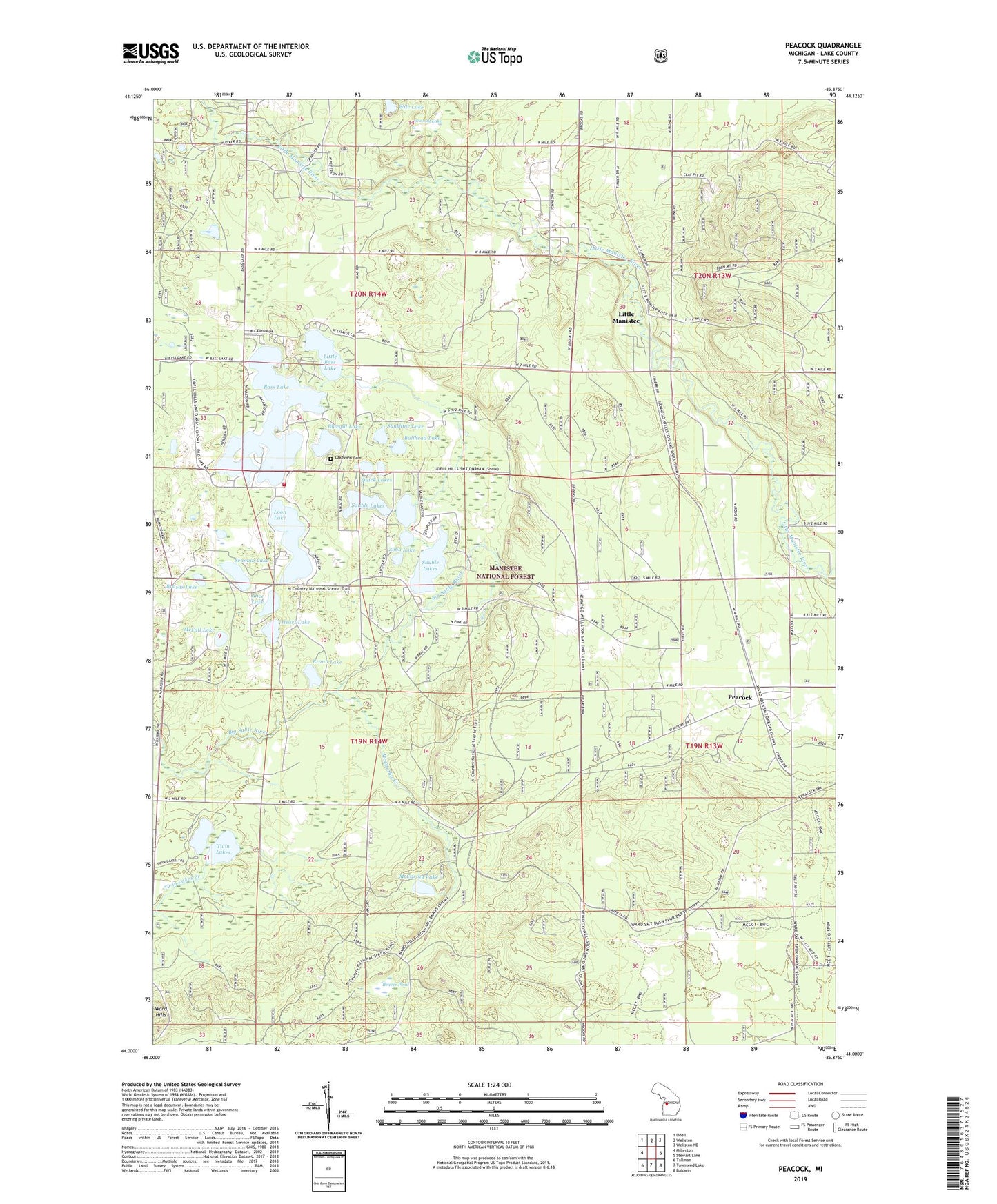
Peacock Michigan US Topo Map
Couldn't load pickup availability
Also explore the Peacock Forest Service Topo of this same quad for updated USFS data
2023 topographic map quadrangle Peacock in the state of Michigan. Scale: 1:24000. Based on the newly updated USGS 7.5' US Topo map series, this map is in the following counties: Lake. The map contains contour data, water features, and other items you are used to seeing on USGS maps, but also has updated roads and other features. This is the next generation of topographic maps. Printed on high-quality waterproof paper with UV fade-resistant inks.
Quads adjacent to this one:
West: Millerton
Northwest: Udell
North: Wellston
Northeast: Wellston NE
East: Stewart Lake
Southeast: Baldwin
South: Townsend Lake
Southwest: Tallman
This map covers the same area as the classic USGS quad with code o44085a8.
Contains the following named places: Alice Lake, Bass Lake, Beaver Pond, Bluegill Lake, Brand Lake, Brasas Lake, Bullhead Lake, Canfields Station, Elk Township Hall, Faith Fellowship Church, Heart Lake, Irons Lookout Tower, Lakeview Cemetery, Leisure Time Campground, Little Bass Lake, Little Manistee, Loon Lake, Lukes Corners, McCarthy Creek, McCarthy Lake, McFall Lake, Peacock, Peacock Post Office, Quick Lakes, Sauble, Sauble - Elk - Eden Township Fire Department Station 1, Sauble Lakes, Sauble Post Office, Sawmill Lake, Seaman Lake, Sunshine Lake, Township of Elk, Township of Sauble, Twin Lakes, Zoba Lake, ZIP Code: 49644