MyTopo
Udell Michigan US Topo Map
Couldn't load pickup availability
Also explore the Udell Forest Service Topo of this same quad for updated USFS data
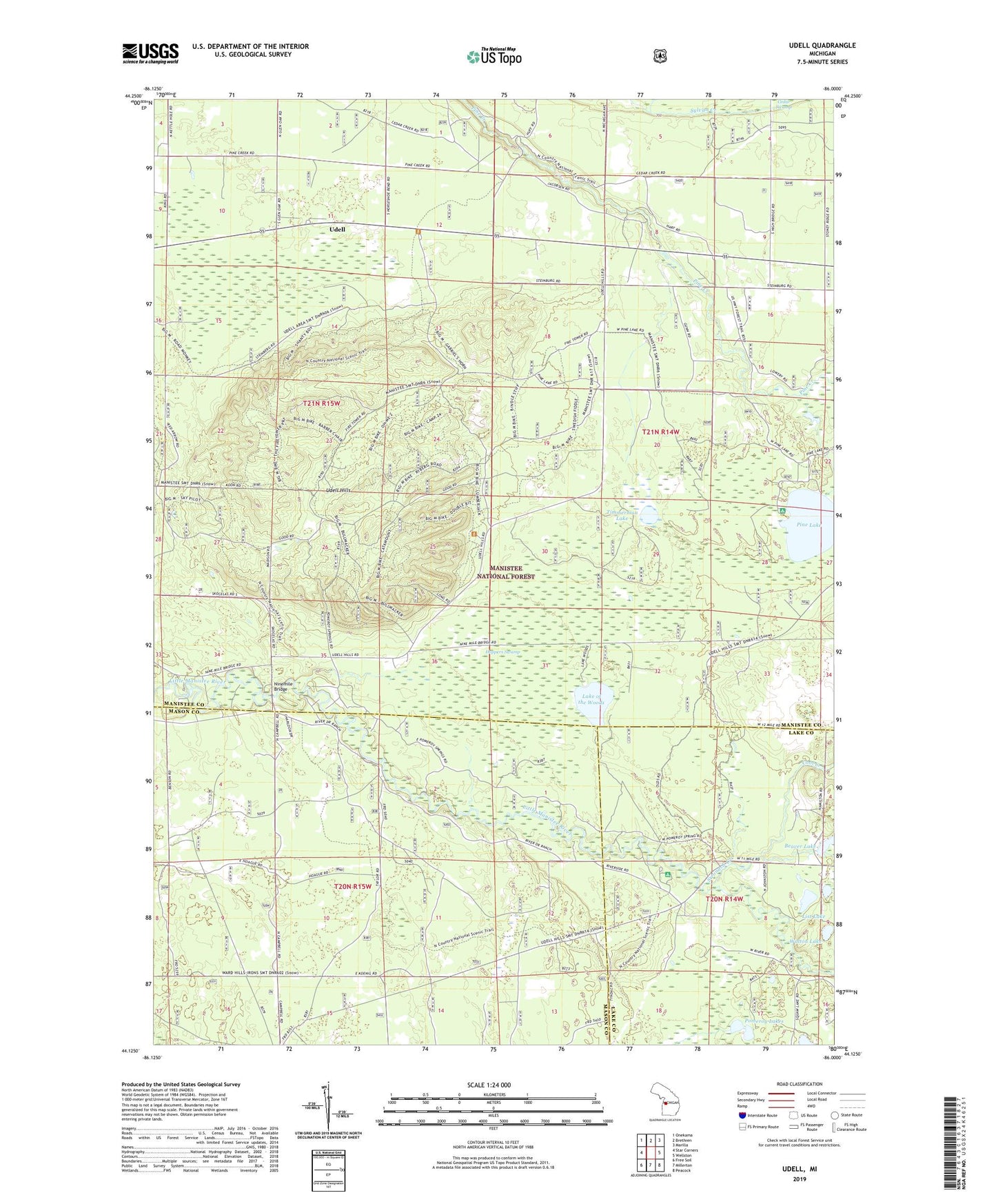
2023 topographic map quadrangle Udell in the state of Michigan. Scale: 1:24000. Based on the newly updated USGS 7.5' US Topo map series, this map is in the following counties: Manistee, Mason, Lake. The map contains contour data, water features, and other items you are used to seeing on USGS maps, but also has updated roads and other features. This is the next generation of topographic maps. Printed on high-quality waterproof paper with UV fade-resistant inks.
Quads adjacent to this one:
West: Star Corners
Northwest: Onekama
North: Brethren
Northeast: Marilla
East: Wellston
Southeast: Peacock
South: Millerton
Southwest: Free Soil
This map covers the same area as the classic USGS quad with code o44086b1.
Contains the following named places: Bear Track Campground, Beaver Lake, Buckwheat Lake, Cool Creek, Glenoak School, Hoppers Swamp, Lake of the Woods, List Lake, Ninemile Bridge, Pine Lake, Pomeroy Lakes, Stronach Creek, Tank Creek, Timmerman Lake, Udell, Udell Hills, Udell Lookout Tower, Walton Lake, Wellston Medical Center