MyTopo
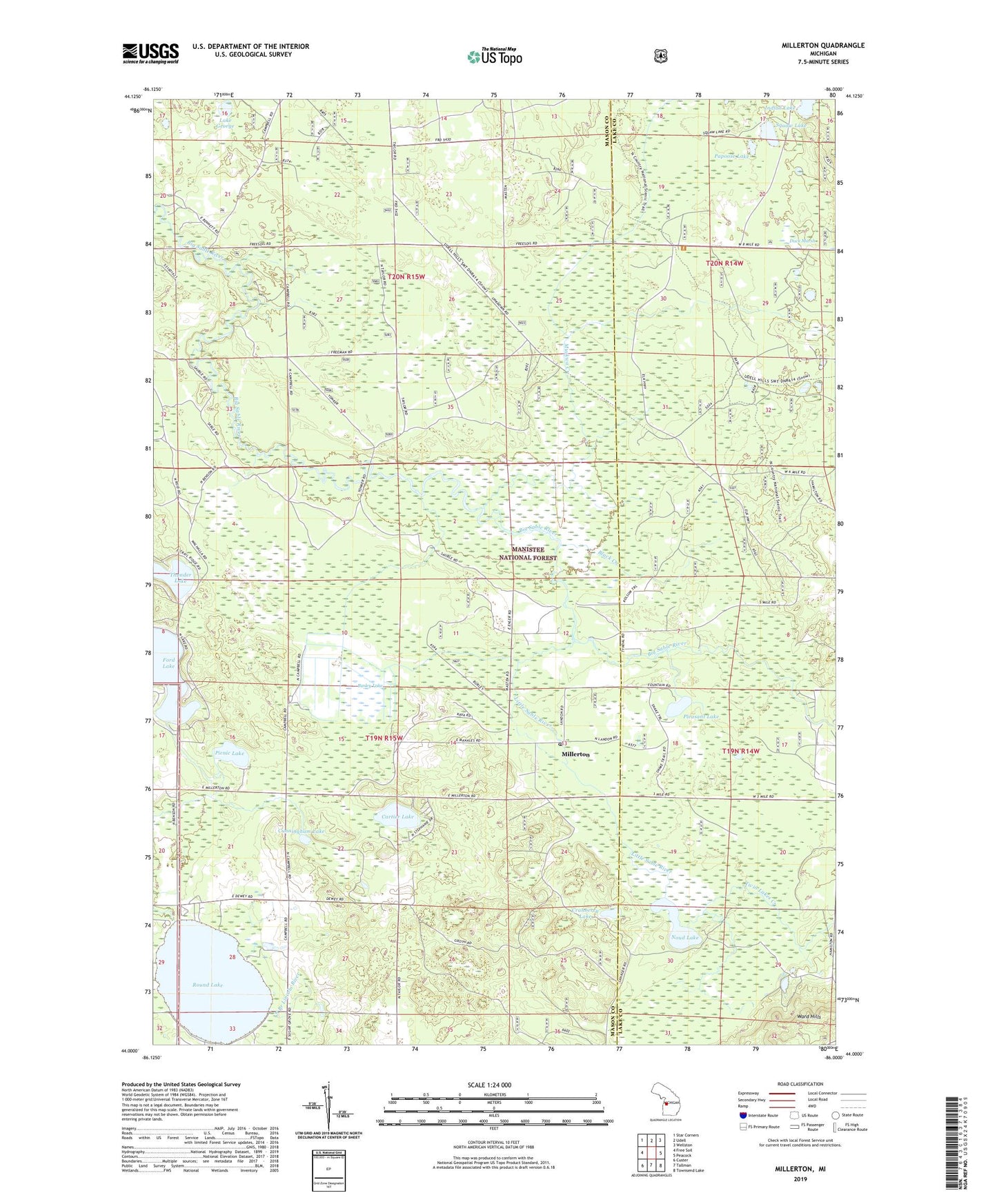
Millerton Michigan US Topo Map
Couldn't load pickup availability
Also explore the Millerton Forest Service Topo of this same quad for updated USFS data
2023 topographic map quadrangle Millerton in the state of Michigan. Scale: 1:24000. Based on the newly updated USGS 7.5' US Topo map series, this map is in the following counties: Mason, Lake. The map contains contour data, water features, and other items you are used to seeing on USGS maps, but also has updated roads and other features. This is the next generation of topographic maps. Printed on high-quality waterproof paper with UV fade-resistant inks.
Quads adjacent to this one:
West: Free Soil
Northwest: Star Corners
North: Udell
Northeast: Wellston
East: Peacock
Southeast: Townsend Lake
South: Tallman
Southwest: Custer
This map covers the same area as the classic USGS quad with code o44086a1.
Contains the following named places: Black Creek, Burley Lake, Cartier Lake, Cranberry Lake, Cunningham Lake, Duck Marsh, Ford Lake, Indian Lake, Lake George, Little Sable River, Millerton, Millerton Post Office, Millerton Station, Muckwa Creek, Noud Lake, Papoose Lake, Picnic Lake, Pleasant Lake, Round Lake, Round Lake School, Saint Joseph Church, Saint Joseph's Catholic Cemetery, Squaw Lake, Thunder Lake, Township of Meade, Township of Sheridan, Twin Lakes Creek