MyTopo
Peck Michigan US Topo Map
Couldn't load pickup availability
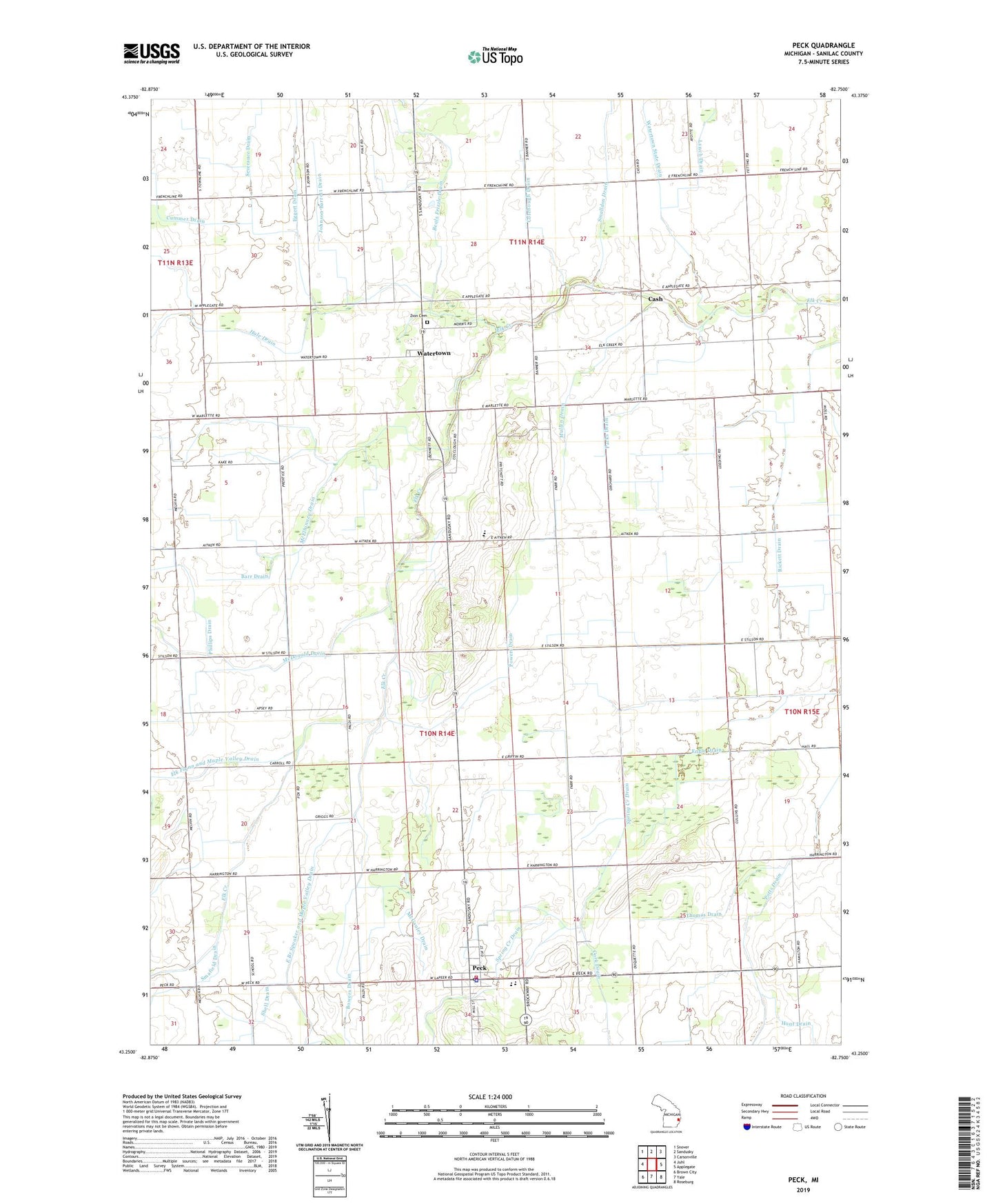
2019 topographic map quadrangle Peck in the state of Michigan. Scale: 1:24000. Based on the newly updated USGS 7.5' US Topo map series, this map is in the following counties: Sanilac. The map contains contour data, water features, and other items you are used to seeing on USGS maps, but also has updated roads and other features. This is the next generation of topographic maps. Printed on high-quality waterproof paper with UV fade-resistant inks.
Quads adjacent to this one:
West: Juhl
Northwest: Snover
North: Sandusky
Northeast: Carsonville
East: Applegate
Southeast: Roseburg
South: Yale
Southwest: Brown City
Contains the following named places: Ball Free Church, Barr Drain, Bowers Drain, Cash, Cash Post Office, Colebough Drain, Cummer Drain, Eggert Drain, Elk Township Fire - Rescue, Elk Township Library, Engle Drain, Fletcher Drain, Hale Drain, Johnson Barrett Drain, Laurel Post Office, Laurel School, Lynch Drain, Lynch School, McDonald Drain, McElhinney Drain, McGauley Drain, Mullen Drain, Parks Drain, Peck, Peck Assembly of God Church, Peck Community Elementary School, Peck Medical Center, Peck Police Department, Peck Post Office, Peck United Methodist Church, Phillips Drain, Powers Drain, Rickett Drain, Saint John Catholic Church, Severance Drain, Smafield Drain, Spring Creek Drain, Thomas Drain, Township of Elk, Village of Peck, Watertown, Watertown Missionary Church, Watertown Post Office, Watertown State Drain, Watertown Station, Williams Field, Zion Cemetery, ZIP Code: 48466