MyTopo
Juhl Michigan US Topo Map
Couldn't load pickup availability
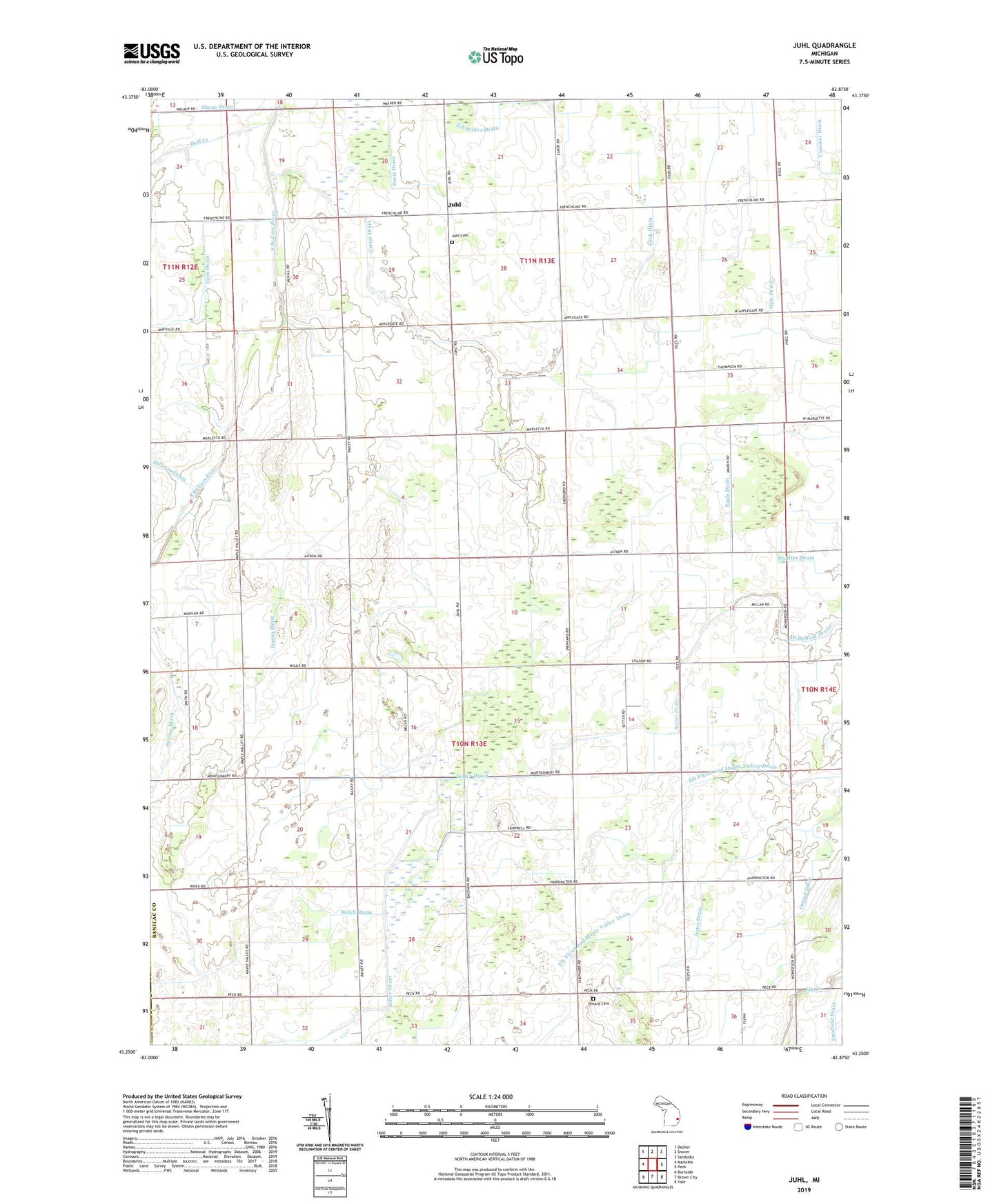
2023 topographic map quadrangle Juhl in the state of Michigan. Scale: 1:24000. Based on the newly updated USGS 7.5' US Topo map series, this map is in the following counties: Sanilac, Lapeer. The map contains contour data, water features, and other items you are used to seeing on USGS maps, but also has updated roads and other features. This is the next generation of topographic maps. Printed on high-quality waterproof paper with UV fade-resistant inks.
Quads adjacent to this one:
West: Marlette
Northwest: Decker
North: Snover
Northeast: Sandusky
East: Peck
Southeast: Yale
South: Brown City
Southwest: Burnside
This map covers the same area as the classic USGS quad with code o43082c8.
Contains the following named places: Carter Drain, Cook Drain, Duff Creek, Eagle Drain, Elk Church, Elk Flynn and Maple Valley Drain, EMS Links Golf Course, Fellowship Bible Church, Fitch Drain, Flynn Church, Frasier Drain, Hope Lutheran Church, Hull School, Jones Drain, Juhl, Juhl Cemetery, Juhl Post Office, Lane School, Laurel Church, Omard Cemetery, Omard Church, Omard Drain, Omard Post Office, Red Star Community Building, Schneider Drain, Setter Drain, Shupe Drain, Spring Drain, Township of Flynn, Welch Drain