MyTopo
Snover Michigan US Topo Map
Couldn't load pickup availability
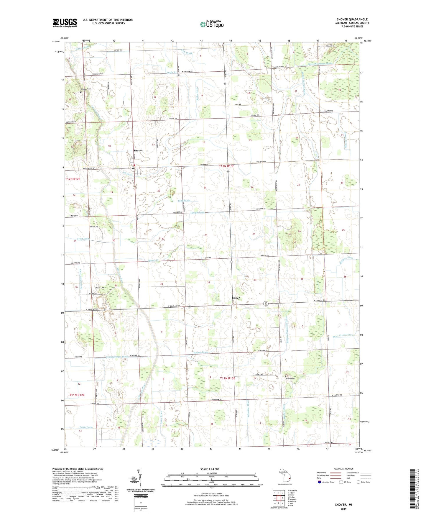
2023 topographic map quadrangle Snover in the state of Michigan. Scale: 1:24000. Based on the newly updated USGS 7.5' US Topo map series, this map is in the following counties: Sanilac. The map contains contour data, water features, and other items you are used to seeing on USGS maps, but also has updated roads and other features. This is the next generation of topographic maps. Printed on high-quality waterproof paper with UV fade-resistant inks.
Quads adjacent to this one:
West: Decker
Northwest: Shabbona
North: Argyle
Northeast: Palms
East: Sandusky
Southeast: Peck
South: Juhl
Southwest: Marlette
This map covers the same area as the classic USGS quad with code o43082d8.
Contains the following named places: Babcock Drain, Badgero Extension Drain, Beaver Creek, Brethren in Christ Church, Davis Drain, Elmer, Elmer Post Office, Elmer School, Gerstenberger Drain, Harrison School, Hendrickson Drain, Heritage United Methodist Church, Hyslop Cemetery, Hyslop Drain, Hyslop School, Johnson Cemetery, Kirby Drain, Minard Drain, Minard School, Moore Church, Moore Township Cemetery, Moore Township Fire Department, Pattie Drain, Ryder Drain, Sandusky Community of Christ Church, Snover, Snover Census Designated Place, Snover Memorial Park, Snover Post Office, Taft Drain, Tank Drain, Temple Drain, Township of Elmer, Township of Moore, Turtle Creek, Urban Church, Urban Post Office, Urban School, Wilson School