MyTopo
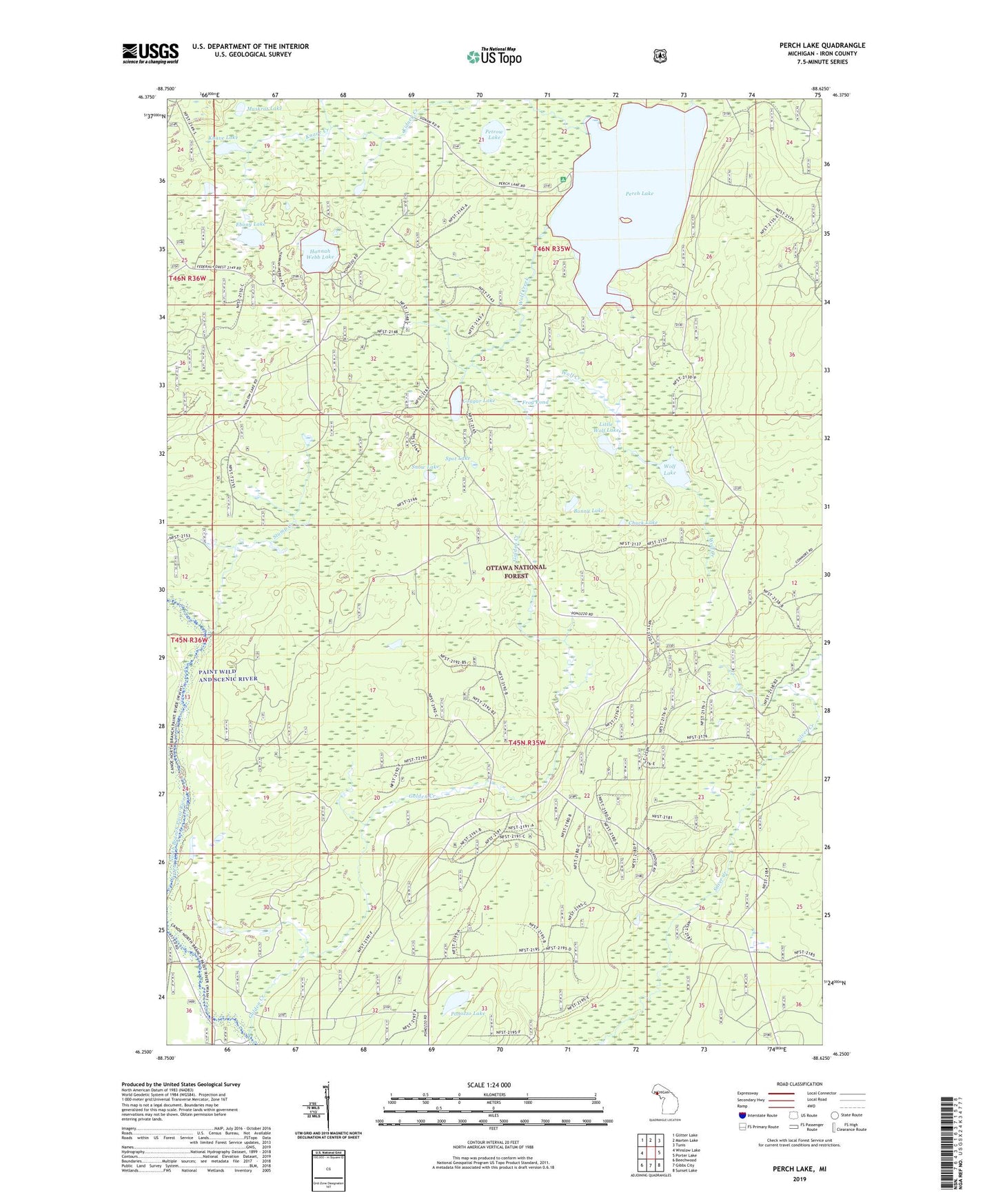
Perch Lake Michigan US Topo Map
Couldn't load pickup availability
Also explore the Perch Lake Forest Service Topo of this same quad for updated USFS data
2023 topographic map quadrangle Perch Lake in the state of Michigan. Scale: 1:24000. Based on the newly updated USGS 7.5' US Topo map series, this map is in the following counties: Iron. The map contains contour data, water features, and other items you are used to seeing on USGS maps, but also has updated roads and other features. This is the next generation of topographic maps. Printed on high-quality waterproof paper with UV fade-resistant inks.
Quads adjacent to this one:
West: Winslow Lake
Northwest: Glitter Lake
North: Marten Lake
Northeast: Tunis
East: Porter Lake
Southeast: Sunset Lake
South: Gibbs City
Southwest: Beechwood
This map covers the same area as the classic USGS quad with code o46088c6.
Contains the following named places: Bonny Lake, Chuck Lake, Cougar Lake, Ebony Lake, Frog Pond, Golden Creek, Hannah Webb Lake, Kidney Creek, Knave Creek, Knave Lake, Little Wolf Lake, Muskrat Lake, Perch Lake, Perch Lake Campground, Perch Lake Lookout Tower, Petrow Lake, Ponozzo Lake, Snow Lake, Spot Lake, Stump Creek, Wolf Creek, Wolf Lake