
MyTopo
Porter Lake Michigan US Topo Map
Couldn't load pickup availability
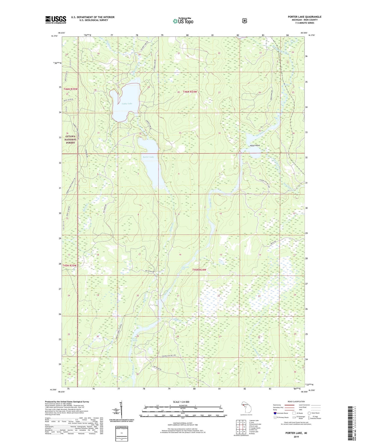
2019 topographic map quadrangle Porter Lake in the state of Michigan. Scale: 1:24000. Based on the newly updated USGS 7.5' US Topo map series, this map is in the following counties: Iron. The map contains contour data, water features, and other items you are used to seeing on USGS maps, but also has updated roads and other features. This is the next generation of topographic maps. Printed on high-quality waterproof paper with UV fade-resistant inks.
Quads adjacent to this one:
West: Perch Lake
Northwest: Marten Lake
North: Tunis
Northeast: Drummond Lake
East: Triangle Ranch
Southeast: Amasa
South: Sunset Lake
Southwest: Gibbs City
Contains the following named places: Barrett Lake, Cable Lake, Cable Lake Creek, Chipmunk Falls, Farley Creek, Hotel Point, Mikes Creek, New York Creek, Pass Creek, Porter Creek, Porter Lake, Snake Rapids, Spring Lake Creek, Township of Bates, Wide Waters


