MyTopo
Republic SW Michigan US Topo Map
Couldn't load pickup availability
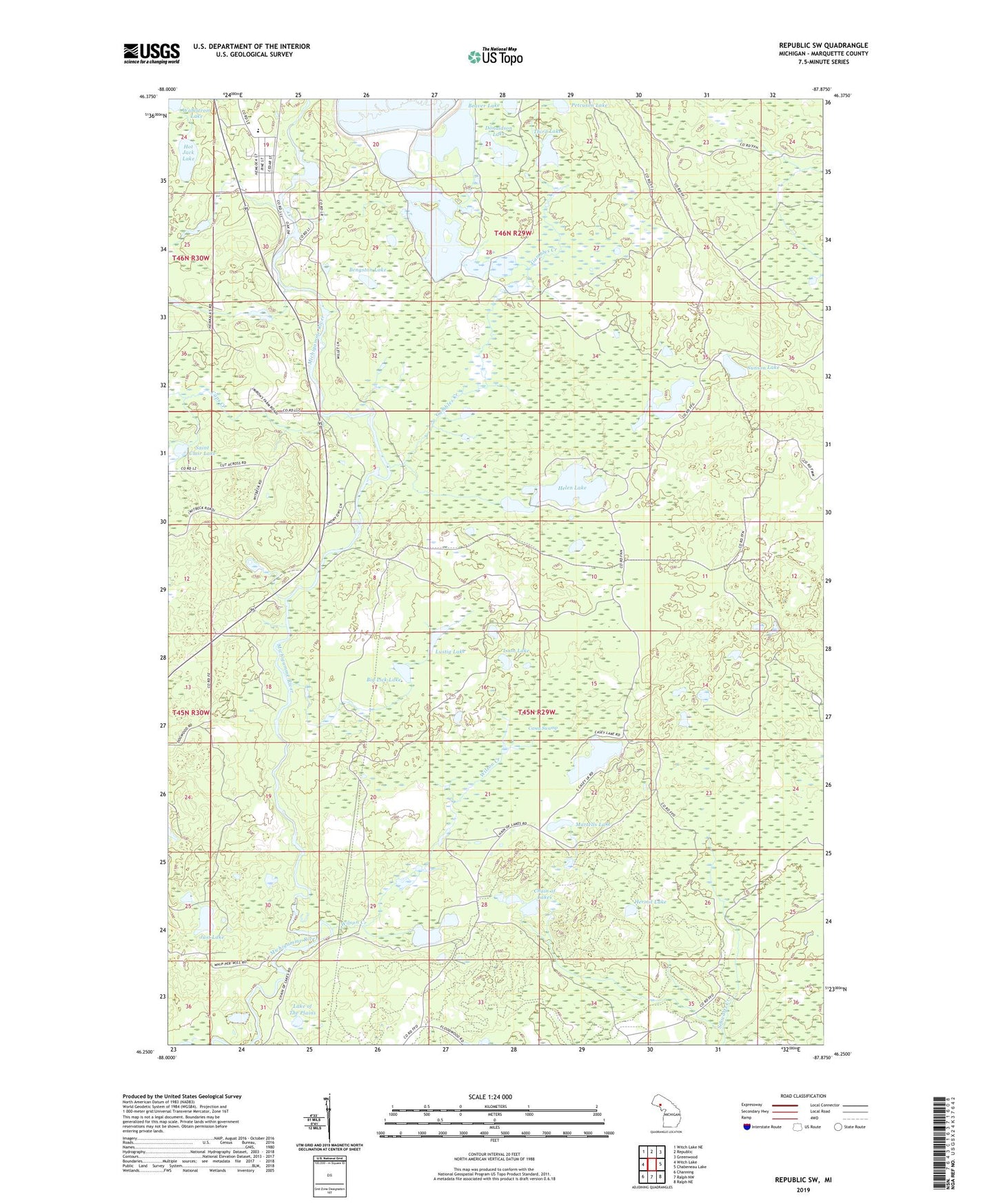
2019 topographic map quadrangle Republic SW in the state of Michigan. Scale: 1:24000. Based on the newly updated USGS 7.5' US Topo map series, this map is in the following counties: Marquette. The map contains contour data, water features, and other items you are used to seeing on USGS maps, but also has updated roads and other features. This is the next generation of topographic maps. Printed on high-quality waterproof paper with UV fade-resistant inks.
Quads adjacent to this one:
West: Witch Lake
Northwest: Witch Lake NE
North: Republic
Northeast: Greenwood
East: Chabeneau Lake
Southeast: Ralph NE
South: Ralph NW
Southwest: Channing
Contains the following named places: Beaver Lake, Bell Medical Family Practice, Bengston Lake, Bethany Lutheran Church, Big Lick Lake, Caps Creek, Casey Lake, Casey Swamp, Chain of Lakes, Donaldson Lake, First Baptist Church, Gambles Creek, Helen Lake, Hermit Lake, Hot Jack Lake, Just Lake, Lake of The Plains, Long Lake, Loon Lake, Lustig Lake, Martells Lake, Petcuson Lake, Peterson Lake, Porterfield Lake, Republic Michigamme Public Library, Republic Michigamme School, Saint Clair Lake, Sunson Lake, Third Lake, Twin Lakes, Wahlstrom Lake, Wilson Creek, Witbeck Rapids Campground