MyTopo
Witch Lake Michigan US Topo Map
Couldn't load pickup availability
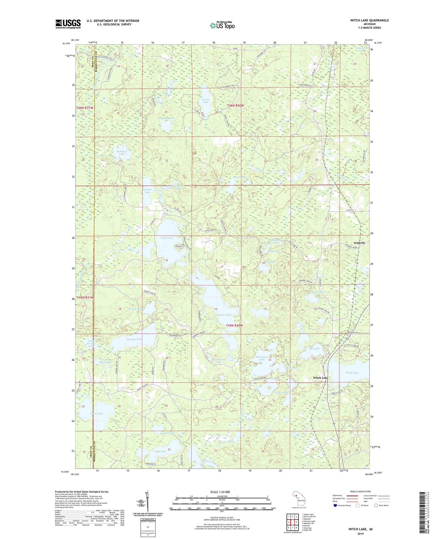
2023 topographic map quadrangle Witch Lake in the state of Michigan. Scale: 1:24000. Based on the newly updated USGS 7.5' US Topo map series, this map is in the following counties: Marquette, Iron. The map contains contour data, water features, and other items you are used to seeing on USGS maps, but also has updated roads and other features. This is the next generation of topographic maps. Printed on high-quality waterproof paper with UV fade-resistant inks.
Quads adjacent to this one:
West: Hickman Lake
Northwest: Nelson Lake
North: Witch Lake NE
Northeast: Republic
East: Republic SW
Southeast: Ralph NW
South: Channing
Southwest: Kiernan
This map covers the same area as the classic USGS quad with code o46088c1.
Contains the following named places: Bat Lake, Bed Spring Lake, Berch Lake, Boys Lake, Bullhead Lake, Camp Fifteen Lake, Chief Lake, Cranberry Lake, Dollar Lake, Fence Lake, Grant Lake, Harris Lake, Haywire Lake, Heart Lake, Horseshoe Lake, Horseshoe Lake State Forest Campground, Island Lake, Lake Elizabeth, Lily Lake, Little Chief Lake, Little Squaw Lake, Little Sundog Lake, Lotto Lake, Mud Lake, Penglase Lake, Pickerel Lake, Simons Lake, Spring Lake, Springhole Lake, Squaw Lake, Squaw Lake State Forest Campground, Sundog Lake, Twin Lakes, Witbeck, Witch Lake, Witch Lake Post Office, Witch Lake Station, ZIP Code: 49879