MyTopo
Resort Lake Michigan US Topo Map
Couldn't load pickup availability
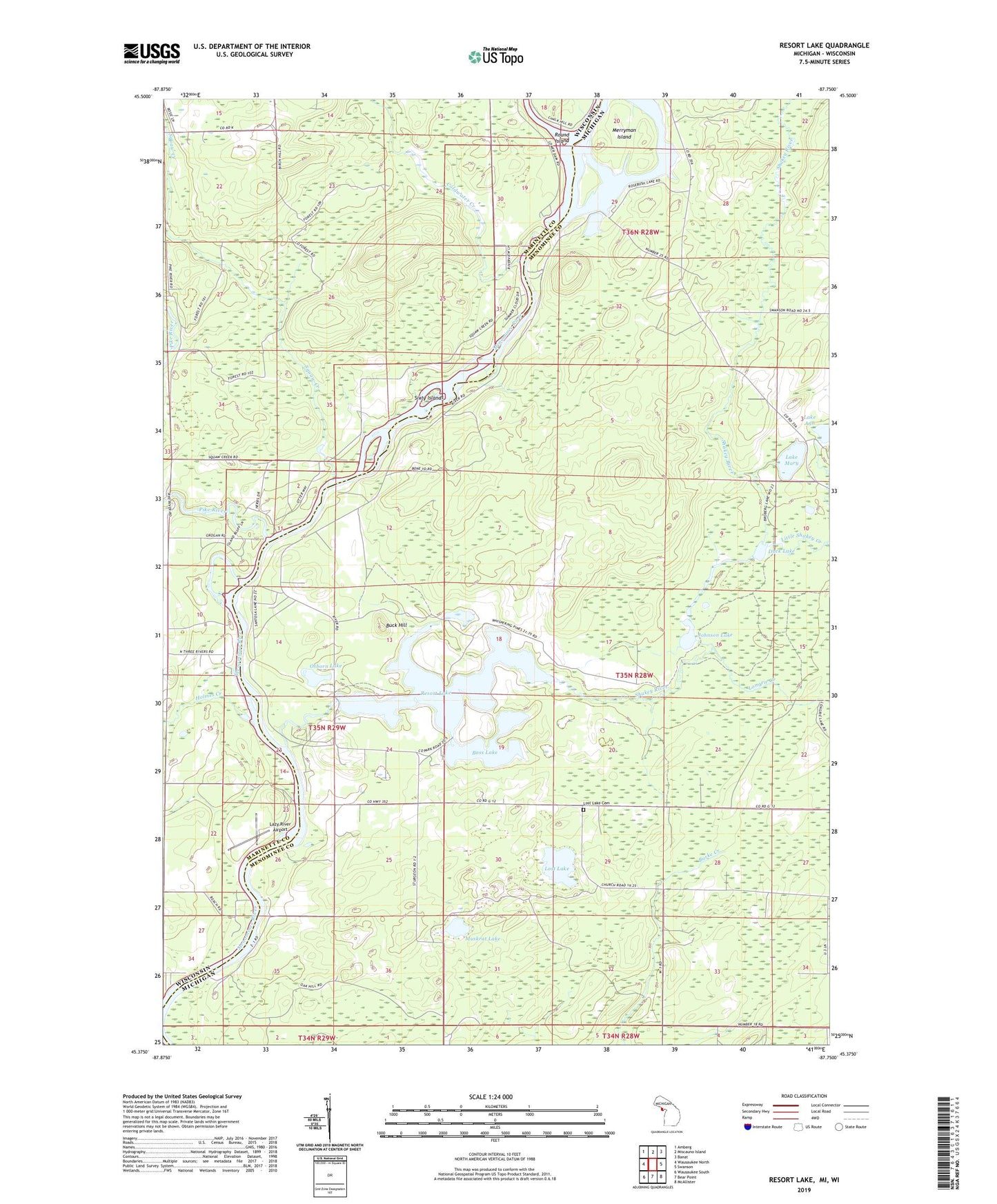
2019 topographic map quadrangle Resort Lake in the states of Michigan, Wisconsin. Scale: 1:24000. Based on the newly updated USGS 7.5' US Topo map series, this map is in the following counties: Menominee, Marinette. The map contains contour data, water features, and other items you are used to seeing on USGS maps, but also has updated roads and other features. This is the next generation of topographic maps. Printed on high-quality waterproof paper with UV fade-resistant inks.
Quads adjacent to this one:
West: Wausaukee North
Northwest: Amberg
North: Miscauno Island
Northeast: Banat
East: Swanson
Southeast: McAllister
South: Bear Point
Southwest: Wausaukee South
Contains the following named places: 10 Reservoir, Baker Lake, Bass Lake, Becher Lake, Buck Hill, Chalk Hill Camp, Coldwater Creek, Duck Lake, East Lake, Holmes Creek, Johnson Lake, Lake Ann, Lake Mary, Lazy River Airport, Little Shakey Creek, Long Lake, Longrie Creek, Lost Lake, Lost Lake Cemetery, Lost Lake Church, Merryman Island, Muskrat Lake, Osborn Lake, Pike River, Pike River School, Resort Lake, Rosebush Creek, Rosebush Lake, Round Island, Shakey Lakes, Shakey Lakes County Park, Shakey River, Sixty Islands, Spring Lake, Squaw Creek, Squaw Creek 2WP1486 Dam, Township of Lake, Wausaukee State Forest, White Rapids Dam