MyTopo
Swanson Michigan US Topo Map
Couldn't load pickup availability
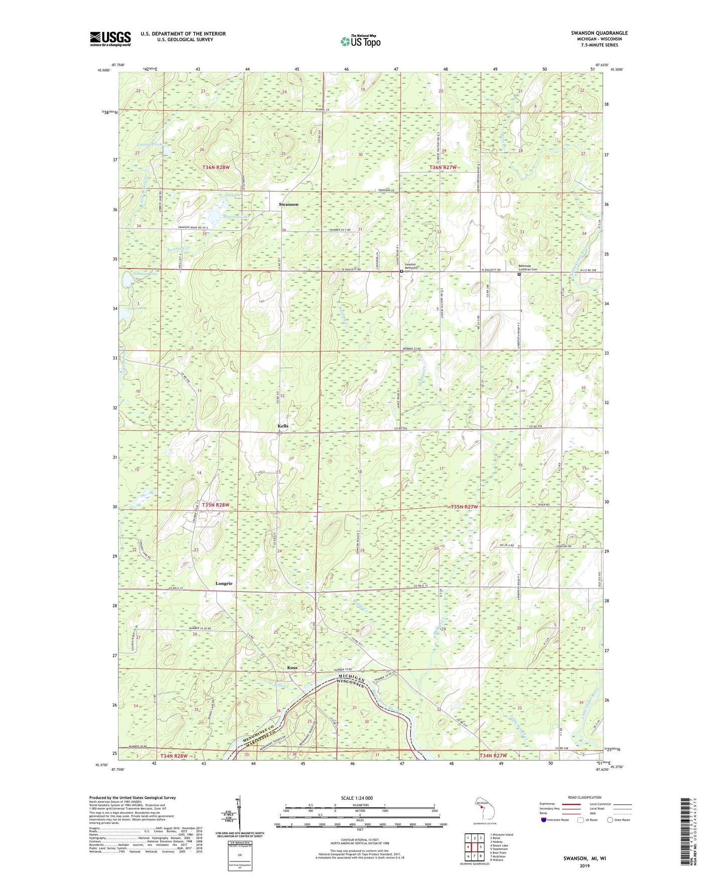
2023 topographic map quadrangle Swanson in the state of Michigan. Scale: 1:24000. Based on the newly updated USGS 7.5' US Topo map series, this map is in the following counties: Menominee, Marinette. The map contains contour data, water features, and other items you are used to seeing on USGS maps, but also has updated roads and other features. This is the next generation of topographic maps. Printed on high-quality waterproof paper with UV fade-resistant inks.
Quads adjacent to this one:
West: Resort Lake
Northwest: Miscauno Island
North: Banat
Northeast: Nadeau
East: Stephenson
Southeast: Wallace
South: McAllister
Southwest: Bear Point
Contains the following named places: Ash Lake, Bethesda Church, Bethesda Lutheran Cemetery, Central Baptist Church, Harding Creek, Johnson Lake, Kells, Kells Post Office, Kells Station, Koss, Koss Creek, Koss Post Office, Koss Station, Linnbeck Lake, Longrie, Longrie Lake, Longrie Station, Menominee County Park, Phillips Creek, Star Corners, Swanson, Swanson Creek, Swanson Lake, Swanson Post Office, Swanson Station, Swedish Methodist Cemetery, Woods Creek, ZIP Code: 49848