MyTopo
Wausaukee North Wisconsin US Topo Map
Couldn't load pickup availability
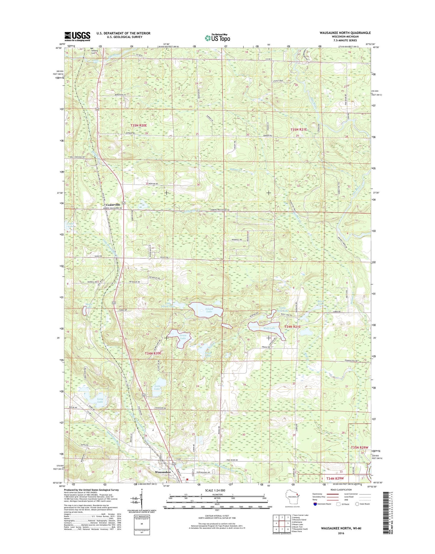
2023 topographic map quadrangle Wausaukee North in the state of Wisconsin. Scale: 1:24000. Based on the newly updated USGS 7.5' US Topo map series, this map is in the following counties: Marinette, Menominee. The map contains contour data, water features, and other items you are used to seeing on USGS maps, but also has updated roads and other features. This is the next generation of topographic maps. Printed on high-quality waterproof paper with UV fade-resistant inks.
Quads adjacent to this one:
West: Athelstane
Northwest: Town Corner Lake
North: Amberg
Northeast: Miscauno Island
East: Resort Lake
Southeast: Bear Point
South: Wausaukee South
Southwest: Mount Tom
This map covers the same area as the classic USGS quad with code o45087d8.
Contains the following named places: Barker School, Bible Camp, Birch Lake, Cedar Lake, Cedarville, Cedarville Creek, Church of Christ, Daves Falls, Daves Falls County Park, Evergreen Park, Fence Lake, Grass Lake, Helen Lake, Island Lake, Little Island Lake, Little Wausaukee Creek, Little Wolf Lake, Long Lake, Lost Lake, Moose Lake, Nulf School, Town of Amberg, Town of Wausaukee, Village of Wausaukee, Wausaukee Elementary School, Wausaukee Junior High School, Wausaukee Middle - High School, Wausaukee Rescue Squad, Wausaukee Volunteer Fire District, Wolf Creek, Wolf Lake, ZIP Code: 54177