MyTopo
Wausaukee South Wisconsin US Topo Map
Couldn't load pickup availability
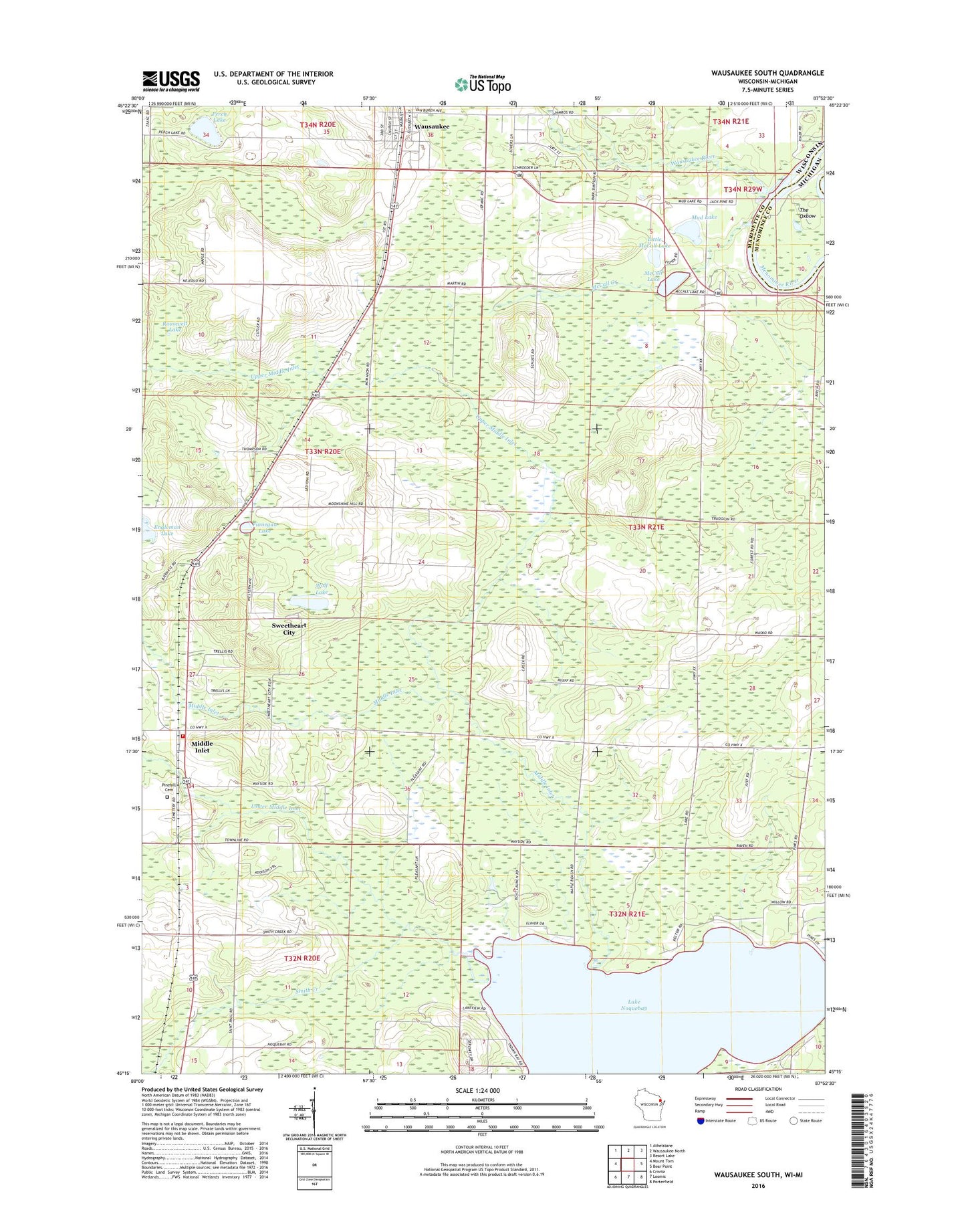
2022 topographic map quadrangle Wausaukee South in the state of Wisconsin. Scale: 1:24000. Based on the newly updated USGS 7.5' US Topo map series, this map is in the following counties: Marinette, Menominee. The map contains contour data, water features, and other items you are used to seeing on USGS maps, but also has updated roads and other features. This is the next generation of topographic maps. Printed on high-quality waterproof paper with UV fade-resistant inks.
Quads adjacent to this one:
West: Mount Tom
Northwest: Athelstane
North: Wausaukee North
Northeast: Resort Lake
East: Bear Point
Southeast: Porterfield
South: Loomis
Southwest: Crivitz
This map covers the same area as the classic USGS quad with code o45087c8.
Contains the following named places: Engleman Lake, Finnegan Lake, Gallow School, Lake Noquebay, Little McCall Lake, Lower Middle Inlet, McCall Creek, McCall Lake, Middle Inlet, Middle Inlet Fire Department, Mud Lake, Perch Lake, Pine Hill Cemetery, Popple Grove School, Roosevelt Lake, Shanebrook School, Smith Creek, Sweetheart City, The Oxbow, Town of Middle Inlet, Upper Middle Inlet, Wausaukee, Wausaukee Post Office, Wausaukee River, Wolf Lake