MyTopo
Rexton Michigan US Topo Map
Couldn't load pickup availability
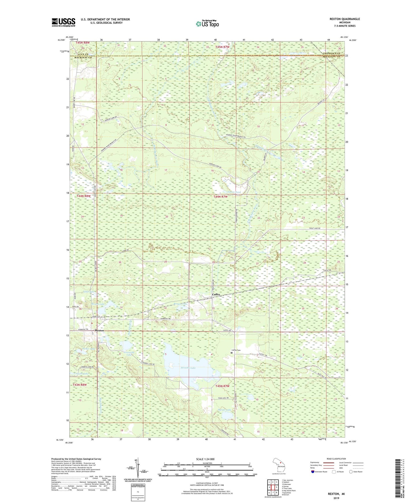
2019 topographic map quadrangle Rexton in the state of Michigan. Scale: 1:24000. Based on the newly updated USGS 7.5' US Topo map series, this map is in the following counties: Mackinac, Chippewa, Luce. The map contains contour data, water features, and other items you are used to seeing on USGS maps, but also has updated roads and other features. This is the next generation of topographic maps. Printed on high-quality waterproof paper with UV fade-resistant inks.
Quads adjacent to this one:
West: Garnet
Northwest: Soo Junction
North: Hulbert
Northeast: Eckerman
East: Trout Lake
Southeast: Brevort
South: Epoufette
Southwest: Hog Island Point
Contains the following named places: Anguilm Creek, Caffey, Caffey Cemetery, Caffey Corner, Caffey Post Office, Caffey Station, Crossville Lake, Fiborn Pond, Fiborn Quarry Post Office, Little Lake, Nelson Creek, Reagan Lake, Rexton, Rexton Lake, Rexton Mennonite Church, Rexton Post Office, Rexton Station, Ryerse Lake, Strouble Lake, Township of Hendricks, Tucker Lake