MyTopo
Roscommon North Michigan US Topo Map
Couldn't load pickup availability
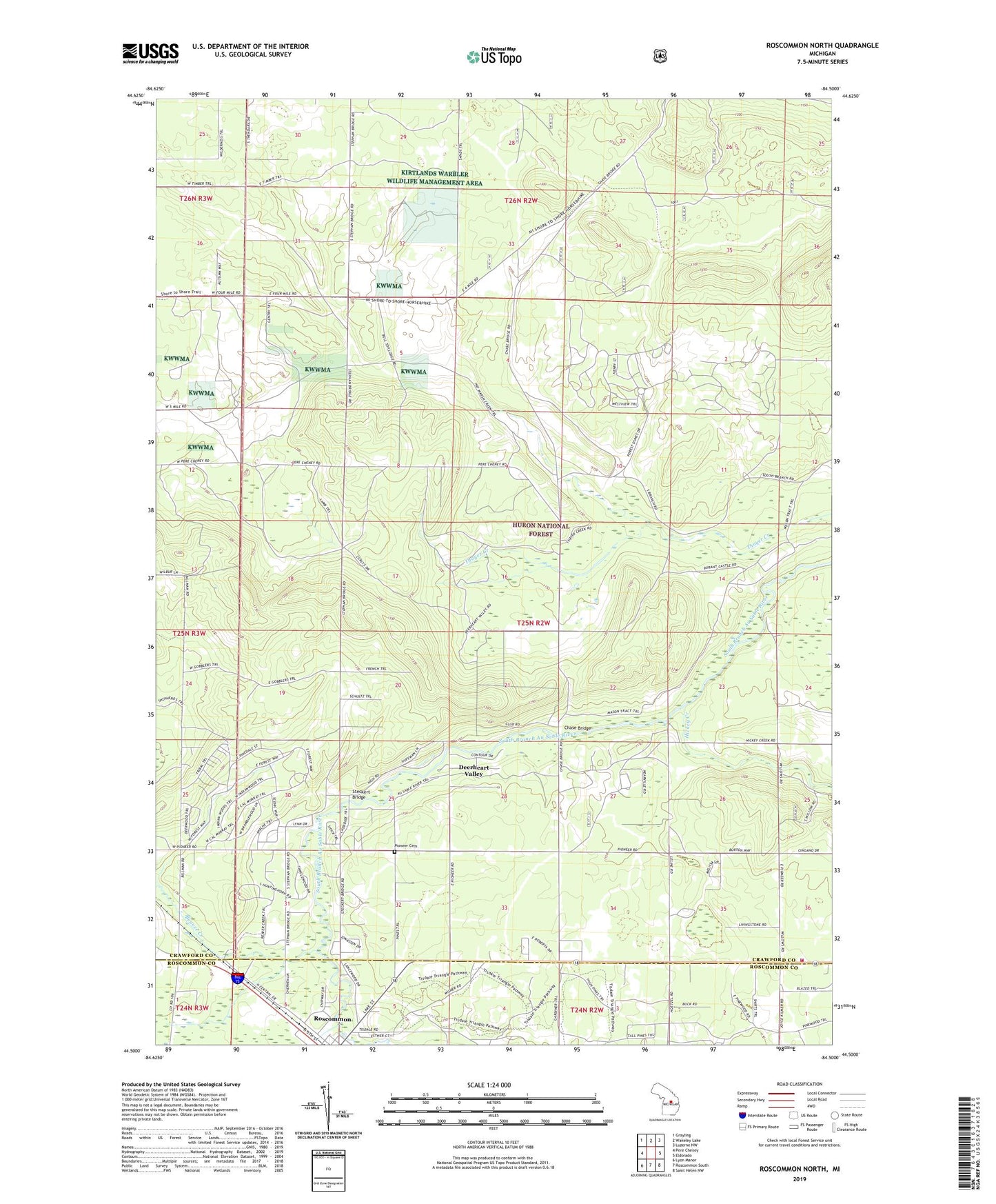
2019 topographic map quadrangle Roscommon North in the state of Michigan. Scale: 1:24000. Based on the newly updated USGS 7.5' US Topo map series, this map is in the following counties: Crawford, Roscommon. The map contains contour data, water features, and other items you are used to seeing on USGS maps, but also has updated roads and other features. This is the next generation of topographic maps. Printed on high-quality waterproof paper with UV fade-resistant inks.
Quads adjacent to this one:
West: Pere Cheney
Northwest: Grayling
North: Wakeley Lake
Northeast: Luzerne NW
East: Eldorado
Southeast: Saint Helen NW
South: Roscommon South
Southwest: Lyon Manor
Contains the following named places: Bay City Hunting and Fishing Club, Beaver Creek, Bell Top Lodge, Chase Bridge, Deerheart Valley, Forest Dunes Golf Club, Four Trail Camp, Hickey Creek, Hilltop Manor Health Care Center, Northern Block and Supply Company, Pioneer Cemetery, Roscommon Free Methodist Church, Saint Michael's Church, South Branch Ranch, South Branch Township Fire and Emergency Medical Services, Steckert Bridge