MyTopo
Pere Cheney Michigan US Topo Map
Couldn't load pickup availability
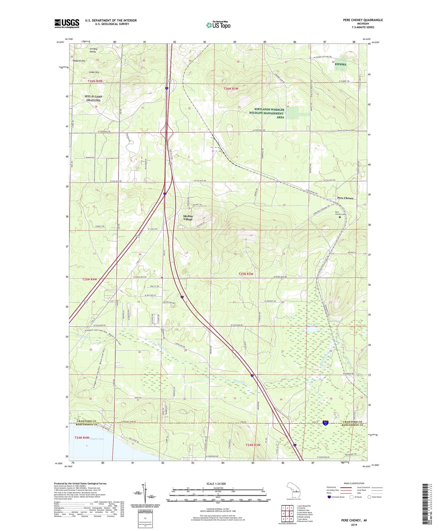
2023 topographic map quadrangle Pere Cheney in the state of Michigan. Scale: 1:24000. Based on the newly updated USGS 7.5' US Topo map series, this map is in the following counties: Crawford, Roscommon. The map contains contour data, water features, and other items you are used to seeing on USGS maps, but also has updated roads and other features. This is the next generation of topographic maps. Printed on high-quality waterproof paper with UV fade-resistant inks.
Quads adjacent to this one:
West: Cote Dame Marie
Northwest: Lake Margrethe
North: Grayling
Northeast: Wakeley Lake
East: Roscommon North
Southeast: Roscommon South
South: Lyon Manor
Southwest: Meads Landing
This map covers the same area as the classic USGS quad with code o44084e6.
Contains the following named places: Au Sable Valley Homes, Bakers Cabins, Beaver Creek Fire Department, Beaver Creek School, Beaver Creek Township Hall, Church of Christ, Department of Conservation Training School, Forest Cabins, Fox Run Country Club, Gerrish Church, Hawk Ridge Golf Course, Higgin Hills RV Park, Higgins Lake Airport, Higgins Lake State Forest, Hogarth Hill, Horrigans Siding, Juvigny Valley, Kefalake Camp, Laurels Pine Well Cabins, Leykaufs Cabins, Little Beaver Creek, Mobile Medical Response Beaver Creek Fire Department, Mud Lake, Pere Cheney, Pere Cheney Cemetery, Pere Cheney Post Office, Pere Cheney Station, Pinewoods Camp, Rays Cabins, Rockefellers Cabins, Sewel Fire Tower, Sinke Hill, Skyline Ski Slide, Skyline Village, Township of Beaver Creek, WGRY-FM (Roscommon), Whispering Pines Cabins, WQON-FM (Grayling)