MyTopo
Roscommon South Michigan US Topo Map
Couldn't load pickup availability
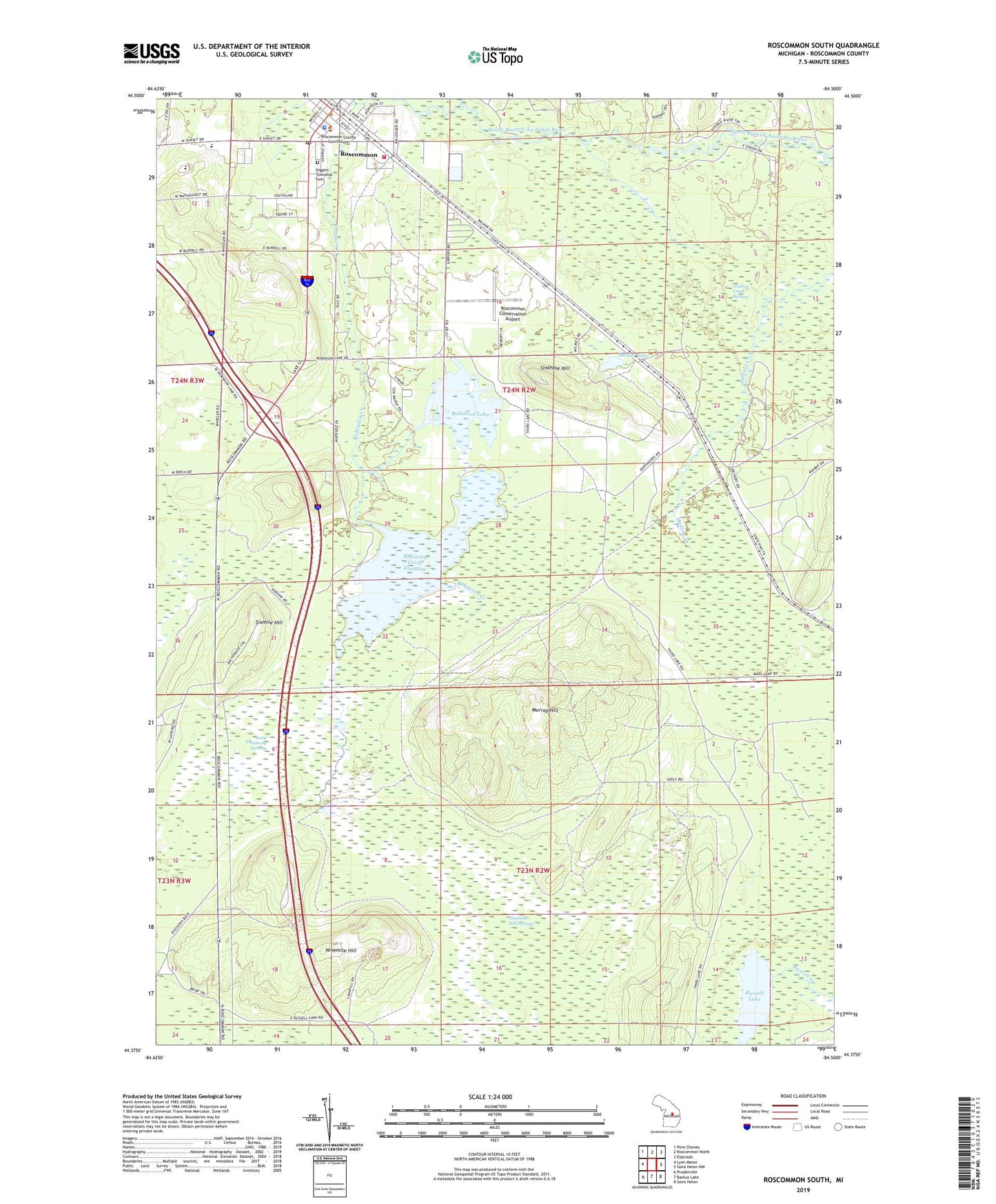
2023 topographic map quadrangle Roscommon South in the state of Michigan. Scale: 1:24000. Based on the newly updated USGS 7.5' US Topo map series, this map is in the following counties: Roscommon. The map contains contour data, water features, and other items you are used to seeing on USGS maps, but also has updated roads and other features. This is the next generation of topographic maps. Printed on high-quality waterproof paper with UV fade-resistant inks.
Quads adjacent to this one:
West: Lyon Manor
Northwest: Pere Cheney
North: Roscommon North
Northeast: Eldorado
East: Saint Helen NW
Southeast: Saint Helen
South: Backus Lake
Southwest: Prudenville
This map covers the same area as the classic USGS quad with code o44084d5.
Contains the following named places: Bambi Lake, First Congregational Church, Gerrish Higgins School, Higgins Township Cemetery, Higgins Township Fire Department - Emergency Medical Services, Higgins Township Hall, Hudson Creek Swamp, Long Crossway Swamp, Marguerite Gahagan Nature Preserve, Mercy Family Care Roscommon, Michigan Department of Natural Resources Forest Mineral And Fire Management Division, Mid Michigan Medical Offices, Moore Station, Murray Hill, Nine Mile Hill Rest Area, Ninemile Hill, Ninemile Hill Swamp, Pioneer House Historical Marker, Robinson Creek, Robinson Creek Dam, Robinson Creek Flooding, Robinson Lake, Roscommon, Roscommon Area Historical Society Museum, Roscommon Baptist Church, Roscommon Conservation Airport, Roscommon County Courthouse, Roscommon County Sheriff's Office, Roscommon Post Office, Roscommon Station, Roscommon Village Hall, Roscommon Walk-In Medical Clinic, Russell Lake, Saint Martin Lutheran Church, Sinkhole Hill, Sixmile Hill, Soul's Harbor Worship Center, Terney House Historical Marker, Township of Higgins, Village of Roscommon, ZIP Code: 48653