MyTopo
Saint Helen Michigan US Topo Map
Couldn't load pickup availability
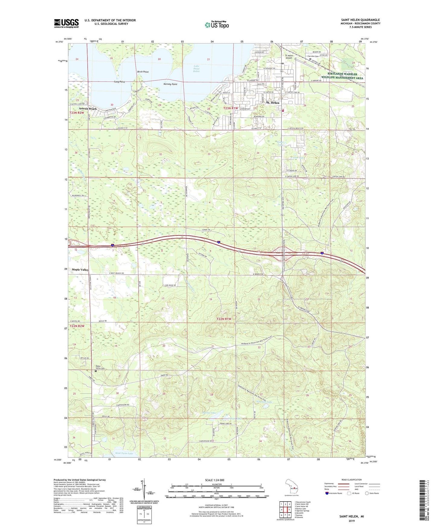
2023 topographic map quadrangle Saint Helen in the state of Michigan. Scale: 1:24000. Based on the newly updated USGS 7.5' US Topo map series, this map is in the following counties: Roscommon. The map contains contour data, water features, and other items you are used to seeing on USGS maps, but also has updated roads and other features. This is the next generation of topographic maps. Printed on high-quality waterproof paper with UV fade-resistant inks.
Quads adjacent to this one:
West: Backus Lake
Northwest: Roscommon South
North: Saint Helen NW
Northeast: Saint Helen NE
East: Ogemaw Springs
Southeast: Edwards
South: Butman
Southwest: Meredith
This map covers the same area as the classic USGS quad with code o44084c4.
Contains the following named places: Artesia Beach, Artesia Beach Campground, Backus Township Hall, Birch Point, Birch Pointe Golf Club, Cameron Creek, Carter Lake, Community Baptist Church, Fairview Cemetery, Fisher Lake, Hope Lutheran Church, Indian Lake, Indian Springs Lookout Tower, Lake Saint Helen, Lakeview Park Indian Cemetery, Long Point, Maple Valley, Maple Valley Cemetery, Ninemile Lake, Norway Point, Richfield Township Public Library, Richfield Township Public Safety Department Fire Station, Richfield Township Public Safety Department Police Station, Saint Helen, Saint Helen Assembly of God Church, Saint Helen Catholic Church, Saint Helen Census Designated Place, Saint Helen Elementary School, Saint Helen Post Office, Saint Helen Station, Shady Lane Trailer Court, Spring Lake, St Helen Airport, Township of Richfield, ZIP Code: 48656