MyTopo
Sand Lake SW Michigan US Topo Map
Couldn't load pickup availability
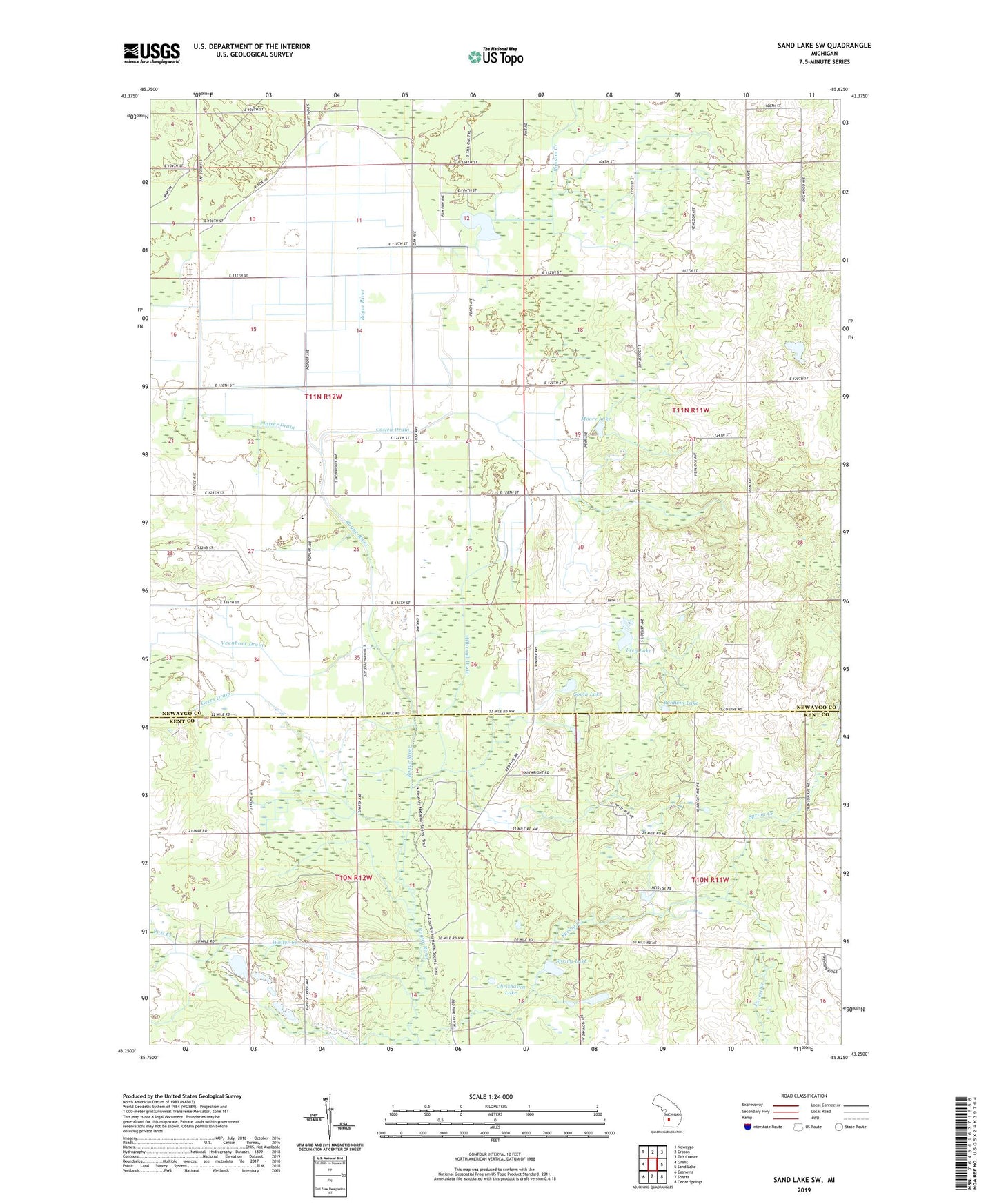
2019 topographic map quadrangle Sand Lake SW in the state of Michigan. Scale: 1:24000. Based on the newly updated USGS 7.5' US Topo map series, this map is in the following counties: Newaygo, Kent. The map contains contour data, water features, and other items you are used to seeing on USGS maps, but also has updated roads and other features. This is the next generation of topographic maps. Printed on high-quality waterproof paper with UV fade-resistant inks.
Quads adjacent to this one:
West: Grant
Northwest: Newaygo
North: Croton
Northeast: Tift Corner
East: Sand Lake
Southeast: Cedar Springs
South: Sparta
Southwest: Casnovia
Contains the following named places: Baldwin Lake, Bellamy Landing Strip, Bolthouse Landing Strip, Butler Lake, Chrishaven Lake, Clear Lake, Costen Drain, Flowing Well School, Frey Lake, Frey School, Geers Drain, Grant Church, Grant School, Harwell Lake, Hickory Creek, Hilbrand Drain, Lady of Guadalupe Mission, Longcore School, Moore Lake, Perrins Post Office, Plaiser Drain, Plumville Post Office, Ransom Creek, Ransom Lake, Red Pine Bible Church, Rice Lake Church, South Lake, Spring Lake, Spring Valley School, Sun, Sun Post Office, Township of Grant, Veenboer Drain, Walter Creek