MyTopo
Croton Michigan US Topo Map
Couldn't load pickup availability
Also explore the Croton Forest Service Topo of this same quad for updated USFS data
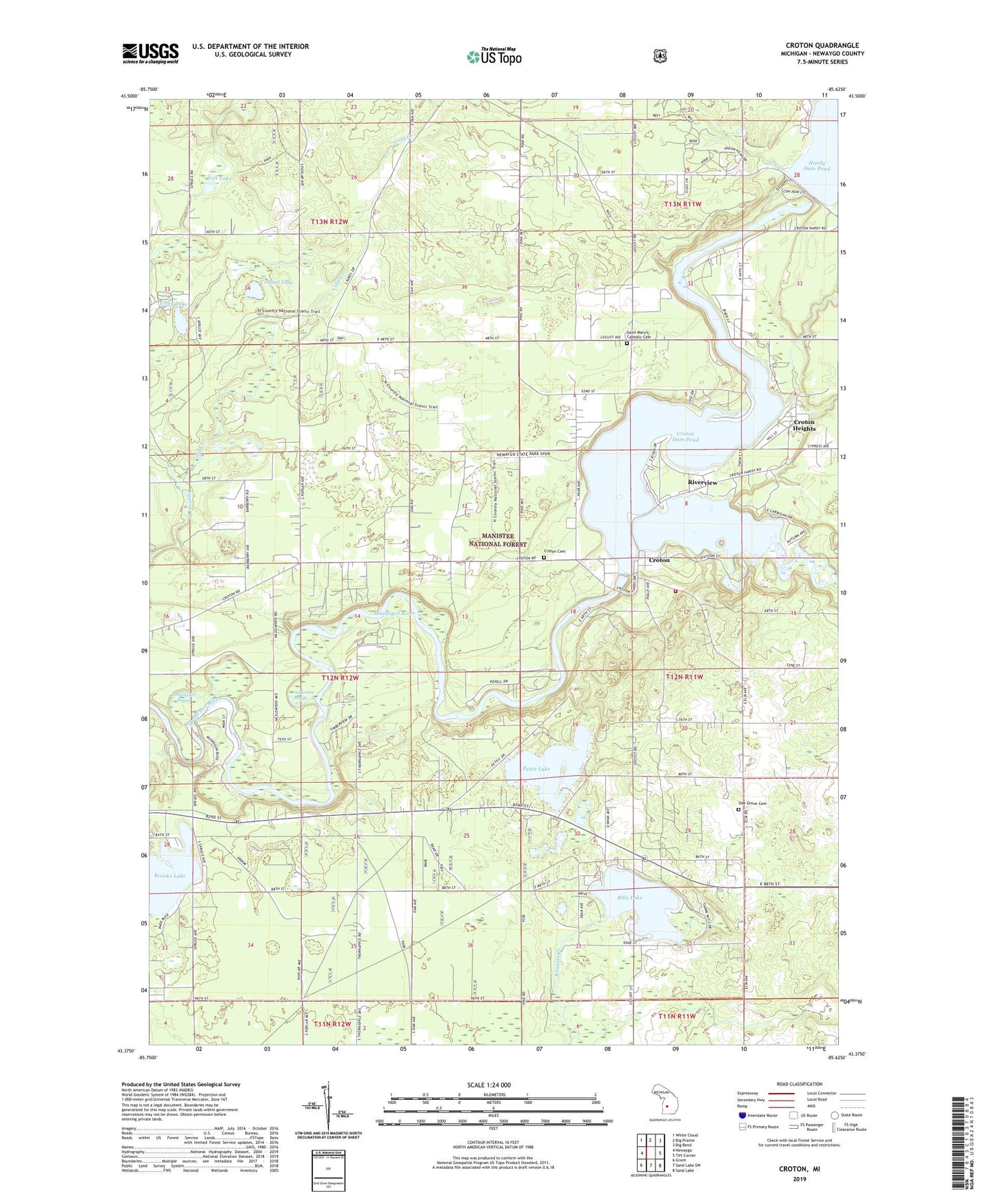
2023 topographic map quadrangle Croton in the state of Michigan. Scale: 1:24000. Based on the newly updated USGS 7.5' US Topo map series, this map is in the following counties: Newaygo. The map contains contour data, water features, and other items you are used to seeing on USGS maps, but also has updated roads and other features. This is the next generation of topographic maps. Printed on high-quality waterproof paper with UV fade-resistant inks.
Quads adjacent to this one:
West: Newaygo
Northwest: White Cloud
North: Big Prairie
Northeast: Big Bend
East: Tift Corner
Southeast: Sand Lake
South: Sand Lake SW
Southwest: Grant
This map covers the same area as the classic USGS quad with code o43085d6.
Contains the following named places: Anderson Bayou, Bills Lake, Bills Lake Baptist Church, Cold Creek, Crofoot Lake, Croton, Croton Cemetery, Croton Community Church, Croton Dam, Croton Dam Pond, Croton Heights, Croton Lookout Tower, Croton Post Office, Croton Township Campground, Croton Township Fire Department, Croton Township Park, Hardy Dam, Hardy Dam County Park, High Rollway Park, High Rollway Public Access, Kimble County Park, Leisure Time RV Park, Life Emergency Medical Services Croton Station, Little Muskegon River, MK Conklin Park, Newaygo Experimental Forest, Oak Grove Cemetery, Oak Grove School, Ottawa Boy Scott Camp, Pettit Lake, Pine Avenue Public Access, Riverview, Saint Mary's Catholic Cemetery, Saint Marys Church, Schumaker Bayou, Toft Lake, Township of Brooks, Utley Lake, ZIP Code: 49337