MyTopo
Saubee Lake Michigan US Topo Map
Couldn't load pickup availability
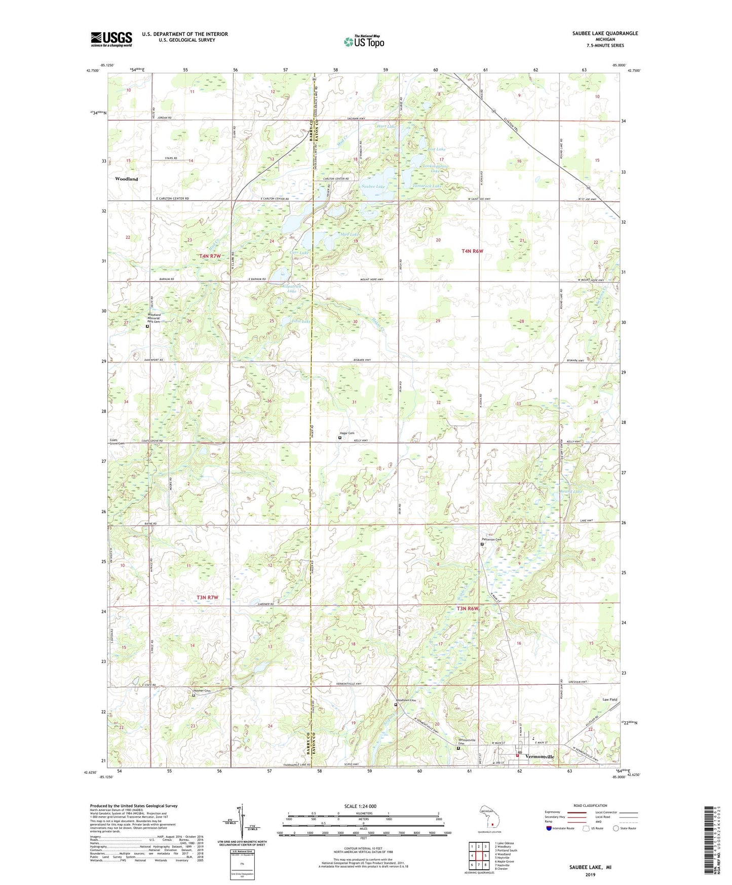
2019 topographic map quadrangle Saubee Lake in the state of Michigan. Scale: 1:24000. Based on the newly updated USGS 7.5' US Topo map series, this map is in the following counties: Eaton, Barry. The map contains contour data, water features, and other items you are used to seeing on USGS maps, but also has updated roads and other features. This is the next generation of topographic maps. Printed on high-quality waterproof paper with UV fade-resistant inks.
Quads adjacent to this one:
West: Woodland
Northwest: Lake Odessa
North: Woodbury
Northeast: Portland South
East: Hoytville
Southeast: Chester
South: Nashville
Southwest: Maple Grove
Contains the following named places: Bismarck Post Office, Bismark School, Blair Post Office, Carr Lake, Chance School, Clinton Junction Post Office, Dellwood Post Office, Durk Lake, First Congregational Church, First Lake, Hagar Cemetery, Hagar Creek, Hagar School, Hart Lake, Hosmer Cemetery, Hosmer School, Hunter School, Kilpatrick Church, Kilpatrick Lake, Lookingglass Lake, Lost Lake, Lovell Pond, Magden School, Maplewood School, Mud Lake, Opera House Historical Marker, Patterson Cemetery, Round Lake, Saddlebag Lake, Saubee Lake, Second Lake, Tamarock Lake, Township of Sunfield, Township of Vermontville, Vermontville, Vermontville Academy Historical Marker, Vermontville Bible Church, Vermontville City Park, Vermontville Fire Station and Emergency Medical Services, Vermontville Methodist Church, Vermontville Post Office, Vermontville Township Library, Vermontville United Methodist Church Historical Marker, Vermontville Woodlawn Cemetery, Village of Vermontville, Woodland Memorial Park Cemetery, Woodlawn Cemetery, Zion Church, ZIP Code: 49096