MyTopo
Nashville Michigan US Topo Map
Couldn't load pickup availability
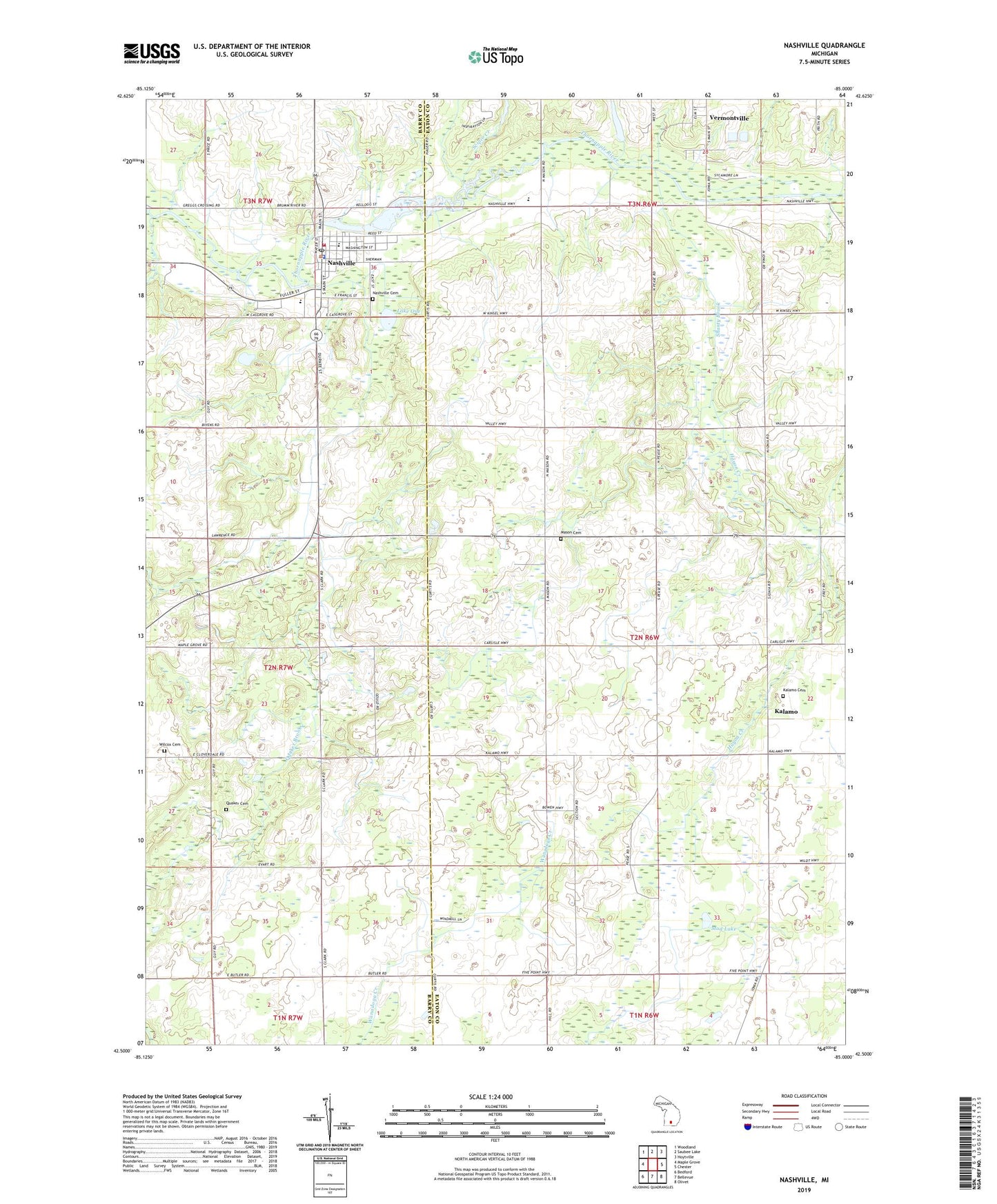
2023 topographic map quadrangle Nashville in the state of Michigan. Scale: 1:24000. Based on the newly updated USGS 7.5' US Topo map series, this map is in the following counties: Eaton, Barry. The map contains contour data, water features, and other items you are used to seeing on USGS maps, but also has updated roads and other features. This is the next generation of topographic maps. Printed on high-quality waterproof paper with UV fade-resistant inks.
Quads adjacent to this one:
West: Maple Grove
Northwest: Woodland
North: Saubee Lake
Northeast: Hoytville
East: Chester
Southeast: Olivet
South: Bellevue
Southwest: Bedford
This map covers the same area as the classic USGS quad with code o42085e1.
Contains the following named places: Assembly of God Church, Barnes School, Beigh School, Castleto - Maple Grove - Nashville Ambulance Service, Castleto - Maple Grove - Nashville Fire Department, Church of the Nazarene, Evans School, First Congregational Church Historical Marker, Grace Community Church, Hayon Creek, Kalamo, Kalamo Cemetery, Kalamo Post Office, Kalamo United Methodist Church, Kellogg Education Center, Lake One, Maple Grove Church, Maple Valley High School, Mason Cemetery, Mason School, Mayo School, Mill Pond, Mud Lake, Nashville, Nashville Baptist Church, Nashville Cemetery, Nashville Family Medicine, Nashville Police Department, Nashville Post Office, Nashville Station, Nashville United Methodist Church, Putnam Public Library, Putnam Public Library Historical Marker, Quail Trap School, Quaker Brook, Quaker Cemetery, Saint Cyril Catholic Church, Scipio Creek, Shanty Brook, Township of Kalamo, Vermontville Station, Village of Nashville, Wilcox Cemetery