MyTopo
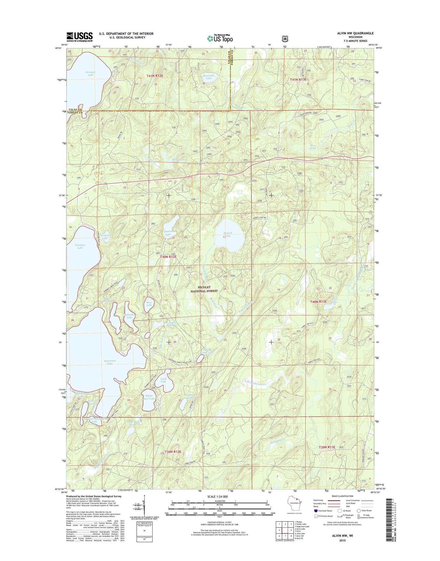
Alvin NW Wisconsin US Topo Map
Couldn't load pickup availability
Also explore the Alvin NW Forest Service Topo of this same quad for updated USFS data
2022 topographic map quadrangle Alvin NW in the state of Wisconsin. Scale: 1:24000. Based on the newly updated USGS 7.5' US Topo map series, this map is in the following counties: Forest, Vilas. The map contains contour data, water features, and other items you are used to seeing on USGS maps, but also has updated roads and other features. This is the next generation of topographic maps. Printed on high-quality waterproof paper with UV fade-resistant inks.
Quads adjacent to this one:
West: Anvil Lake
Northwest: Phelps
North: Smoky Lake
Northeast: Hagerman Lake
East: Alvin
Southeast: Alvin SE
South: Alvin SW
Southwest: Julia Lake
This map covers the same area as the classic USGS quad with code o45088h8.
Contains the following named places: Bose Lake, Bose Lake Hemlock-Hardwoods State Natural Area, Briss Lake, Brule Springs, Butternut Lake, Camp 14, Camp White Deer, Forks Dam, Four Ducks Lake, Franklin Lake Campground, Griswolds Camp, Harmony Lake, Harriet Lake, Howell Creek, Howell Lake, Indian Camp Lake, Kentuck Creek, Kentuck Lake, Kentuck Lake Campground, Lone Wolf Lake, Luna Lake, Luna-White Deer Campground, Mayflower Lake, McKinley Lake, North Branch McDonald Creek, Perry Spring, Quartz Lake, Reservoir Lake, Rosen Dam, Sunfish Lake, Three Johns Lake, Two Dutchmen Lake, Two Sisters Lakes, White Deer Lake