MyTopo
Sprinkler Lake Michigan US Topo Map
Couldn't load pickup availability
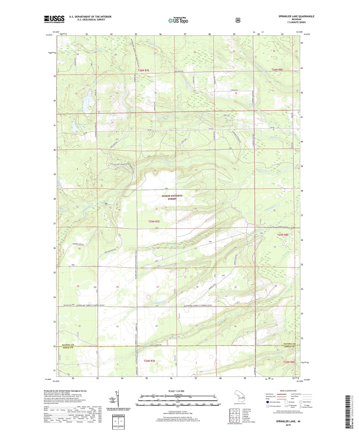
2019 topographic map quadrangle Sprinkler Lake in the state of Michigan. Scale: 1:24000. Based on the newly updated USGS 7.5' US Topo map series, this map is in the following counties: Alcona, Iosco. The map contains contour data, water features, and other items you are used to seeing on USGS maps, but also has updated roads and other features. This is the next generation of topographic maps. Printed on high-quality waterproof paper with UV fade-resistant inks.
Quads adjacent to this one:
West: Glennie
Northwest: Bucks Pond
North: Barton City
Northeast: Lincoln
East: Mikado
Southeast: Foote Site Village
South: Sid Town
Southwest: Loud Dam
Contains the following named places: Bryant Creek, DeLap Lake, Howard Park, Kurtz Creek, Pine River Campground, Samyn Creek, Sprinkler Lake, Township of Mikado, Vandercook Creek, Wallace Creek