MyTopo
Stateline Lake Michigan US Topo Map
Couldn't load pickup availability
Also explore the Stateline Lake Forest Service Topo of this same quad for updated USFS data
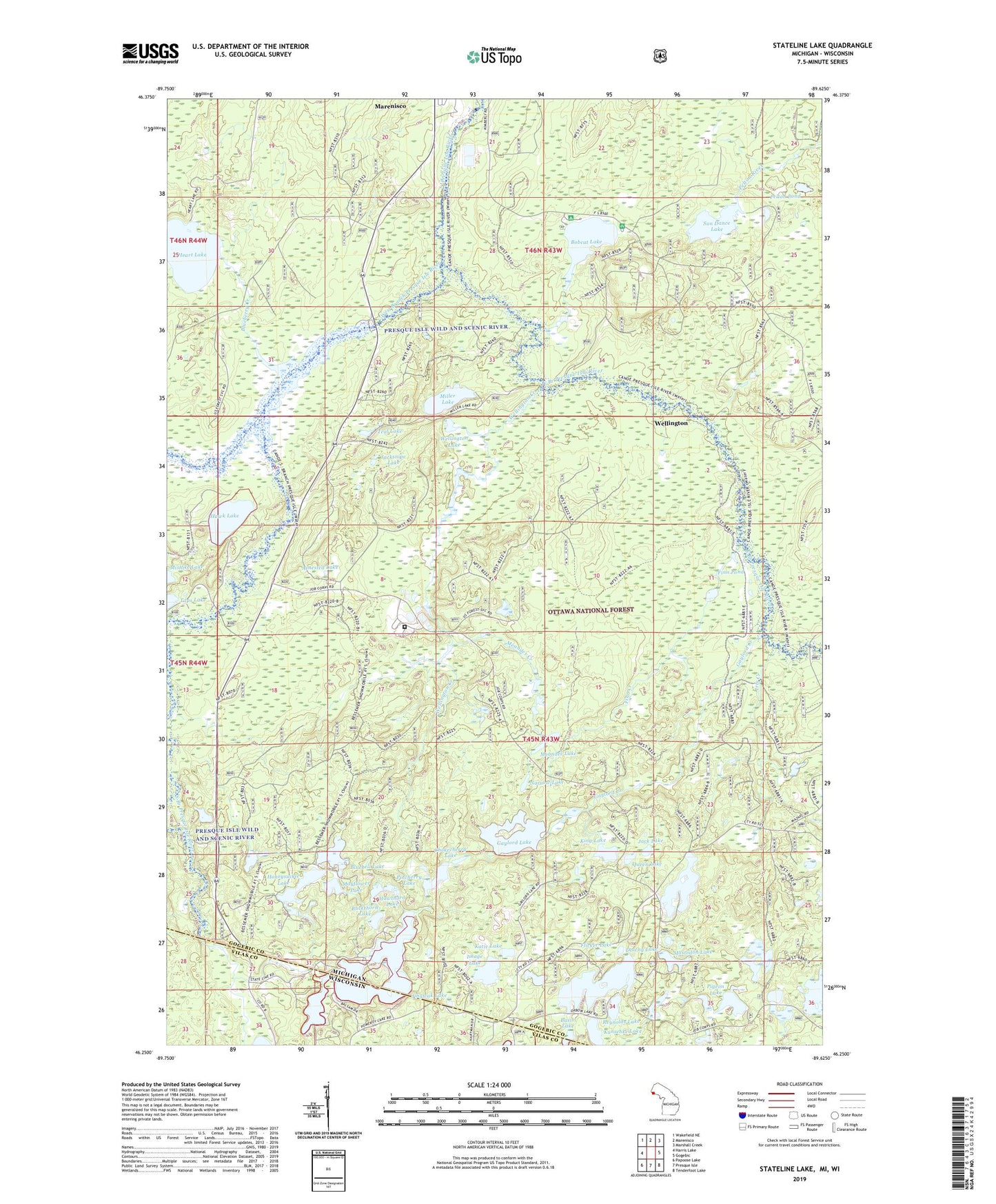
2023 topographic map quadrangle Stateline Lake in the states of Michigan, Wisconsin. Scale: 1:24000. Based on the newly updated USGS 7.5' US Topo map series, this map is in the following counties: Gogebic, Vilas. The map contains contour data, water features, and other items you are used to seeing on USGS maps, but also has updated roads and other features. This is the next generation of topographic maps. Printed on high-quality waterproof paper with UV fade-resistant inks.
Quads adjacent to this one:
West: Harris Lake
Northwest: Wakefield NE
North: Marenisco
Northeast: Marshall Creek
East: Gogebic
Southeast: Tenderfoot Lake
South: Presque Isle
Southwest: Papoose Lake
Contains the following named places: Arnested Lake, Basin Lake, Bluebell Lake, Blueberry Creek, Bobcat Creek, Bobcat Lake, Bobcat Lake Campground, Bobcat Lake Picnic Area, Buckthorn Lake, Camp Ojibway, Chokecherry Lake, Downy Lake, East Branch Presque Isle River, Finn Creek, Finn Pond, Flicker Lake, Gaylord Creek, Gaylord Lake, Hawk Lake, Hawthorn Lake, Heart Lake, Honeysuckle Lake, Image Lake, Iris Creek, Jack Lake, Jacksnipe Lake, Jingwak Lake, Katie Lake, King Lake, Kunschke Lake, Little Oxbow Lake, Marenisco Census Designated Place, Mastodon Lake, Mayflower Lake, Meander Creek, Meander Lake, Miller Lake, Narrow Lake, Ojibway Correctional Facility, Ormes Lake, Pelton Pond, Pigeon Lake, Pincherry Lake, Presque Isle River Flooding, Queen Lake, Reynolds Lake, South Branch Presque Isle River, Stateline Lake, Summit Lake, Sun Dance Lake, Taps Lake, Teal Lake, Wellington, Wellington Creek, Wellington Lake, West Branch Presque Isle River