MyTopo
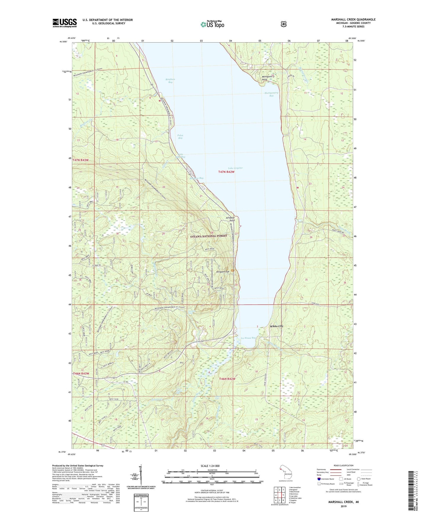
Marshall Creek Michigan US Topo Map
Couldn't load pickup availability
Also explore the Marshall Creek Forest Service Topo of this same quad for updated USFS data
2023 topographic map quadrangle Marshall Creek in the state of Michigan. Scale: 1:24000. Based on the newly updated USGS 7.5' US Topo map series, this map is in the following counties: Gogebic. The map contains contour data, water features, and other items you are used to seeing on USGS maps, but also has updated roads and other features. This is the next generation of topographic maps. Printed on high-quality waterproof paper with UV fade-resistant inks.
Quads adjacent to this one:
West: Marenisco
Northwest: Merriweather
North: Bergland
Northeast: Matchwood
East: Cup Lake
Southeast: Thayer
South: Gogebic
Southwest: Stateline Lake
This map covers the same area as the classic USGS quad with code o46089d5.
Contains the following named places: Alligator Eye, Alligator Eye Trail, Alligator Point, Big Bear Bay, Bingham Bay, Bingham Creek, Gillis Creek, Gogebic County Park, Gogebic Lake State Park, Ice House Bay, Judson Falls, Lake Gogebic Volunteer Fire Department Station 2 - East Shore, Lake Gogebic Volunteer Fire Department Station 2 West Shore, Little Bear Bay, Marshall Creek, Marshall Falls, Montgomery Bay, Montgomery Creek, Montgomery Point, Nelson Canyon Falls, Nelson Creek, Pabst Bay, Pelton River, Saint Thomas Church Camp, Slate River, Township of Marenisco, Trout Brook, White City, White Horse Creek, ZIP Code: 49947