MyTopo
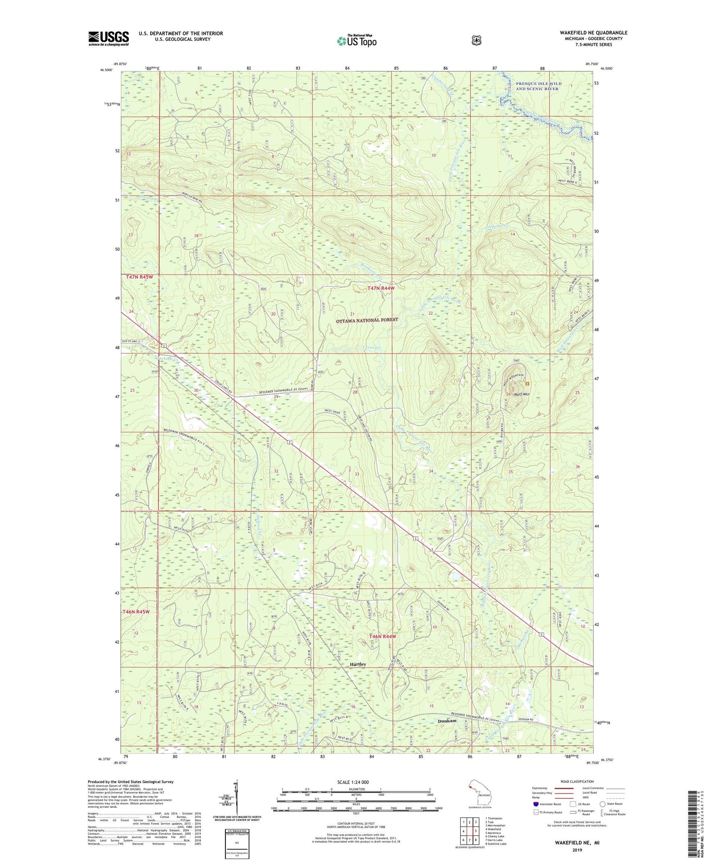
Wakefield NE Michigan US Topo Map
Couldn't load pickup availability
Also explore the Wakefield NE Forest Service Topo of this same quad for updated USFS data
2023 topographic map quadrangle Wakefield NE in the state of Michigan. Scale: 1:24000. Based on the newly updated USGS 7.5' US Topo map series, this map is in the following counties: Gogebic. The map contains contour data, water features, and other items you are used to seeing on USGS maps, but also has updated roads and other features. This is the next generation of topographic maps. Printed on high-quality waterproof paper with UV fade-resistant inks.
Quads adjacent to this one:
West: Wakefield
Northwest: Thomaston
North: Tula
Northeast: Merriweather
East: Marenisco
Southeast: Stateline Lake
South: Harris Lake
Southwest: Chaney Lake
This map covers the same area as the classic USGS quad with code o46089d7.
Contains the following named places: Brotherton Creek, Cumberland Creek, Dunham, Dunham Post Office, Dunham Station, Emperor Creek, Gogebic County, Hartley, Hide-Away Village Landing Strip, Little Presque Isle River, McVichie Creek, Monarch Creek, Veron Creek, Wolf Mountain, Wolf Mountain Creek