
MyTopo
Stittsville Michigan US Topo Map
Couldn't load pickup availability
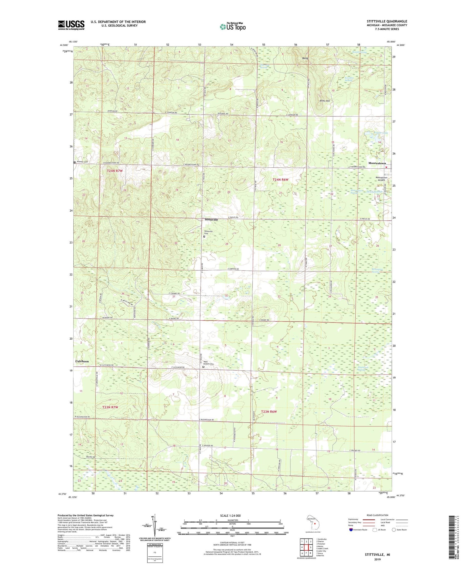
2019 topographic map quadrangle Stittsville in the state of Michigan. Scale: 1:24000. Based on the newly updated USGS 7.5' US Topo map series, this map is in the following counties: Missaukee. The map contains contour data, water features, and other items you are used to seeing on USGS maps, but also has updated roads and other features. This is the next generation of topographic maps. Printed on high-quality waterproof paper with UV fade-resistant inks.
Quads adjacent to this one:
West: Morey
Northwest: Smithville
North: Sharon
Northeast: Fletcher
East: Addis Creek
Southeast: Merritt
South: Dinca
Southwest: Lake City
Contains the following named places: Allen Hill, Baldy, Excelsior Swamp, Fagan Lake, Moorestown, Moorestown Post Office, Moorestown Swamp, Moorestown-Stittsville United Methodist Church, Norwich Township Fire Department, Norwich Township Hall, Pioneer Cemetery, Round Swamp, Stittsville, Stittsville Cemetery, Stittsville Post Office, Sunnyside School, Thornton Swamp, Township of West Branch, West Branch Cemetery, ZIP Code: 49651


