MyTopo
Morey Michigan US Topo Map
Couldn't load pickup availability
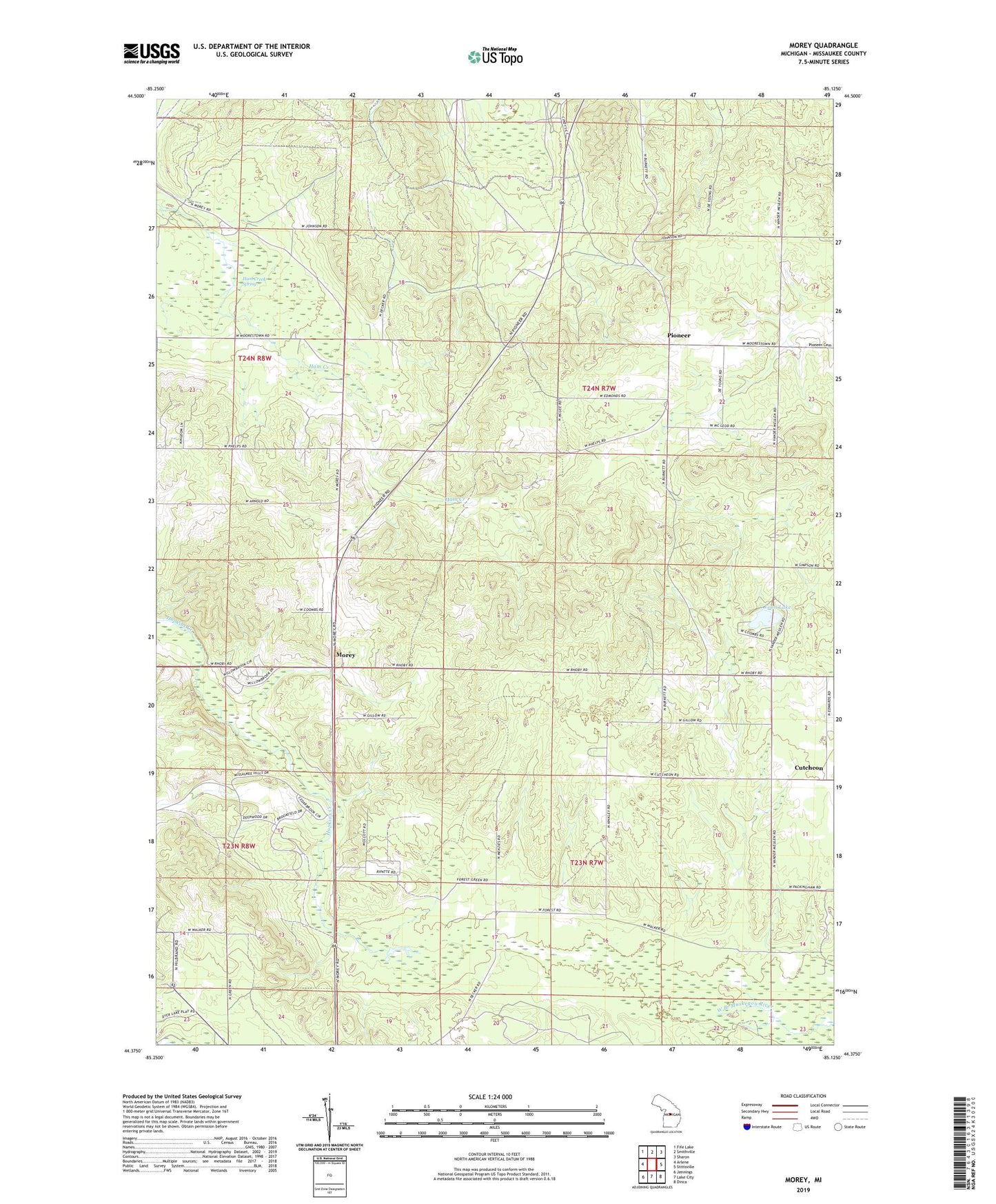
2023 topographic map quadrangle Morey in the state of Michigan. Scale: 1:24000. Based on the newly updated USGS 7.5' US Topo map series, this map is in the following counties: Missaukee. The map contains contour data, water features, and other items you are used to seeing on USGS maps, but also has updated roads and other features. This is the next generation of topographic maps. Printed on high-quality waterproof paper with UV fade-resistant inks.
Quads adjacent to this one:
West: Arlene
Northwest: Fife Lake
North: Smithville
Northeast: Sharon
East: Stittsville
Southeast: Dinca
South: Lake City
Southwest: Jennings
This map covers the same area as the classic USGS quad with code o44085d2.
Contains the following named places: Cutcheon, Cutcheon Post Office, Ham Creek Spring, Lamb School, Loon Lake, Missaukee Mountain Ski Area, Morey, Morey Church, Morey Post Office, Pioneer, Pioneer Post Office, Pioneer School, Pioneer Township Park, Township of Forest, Township of Pioneer