MyTopo
Lake City Michigan US Topo Map
Couldn't load pickup availability
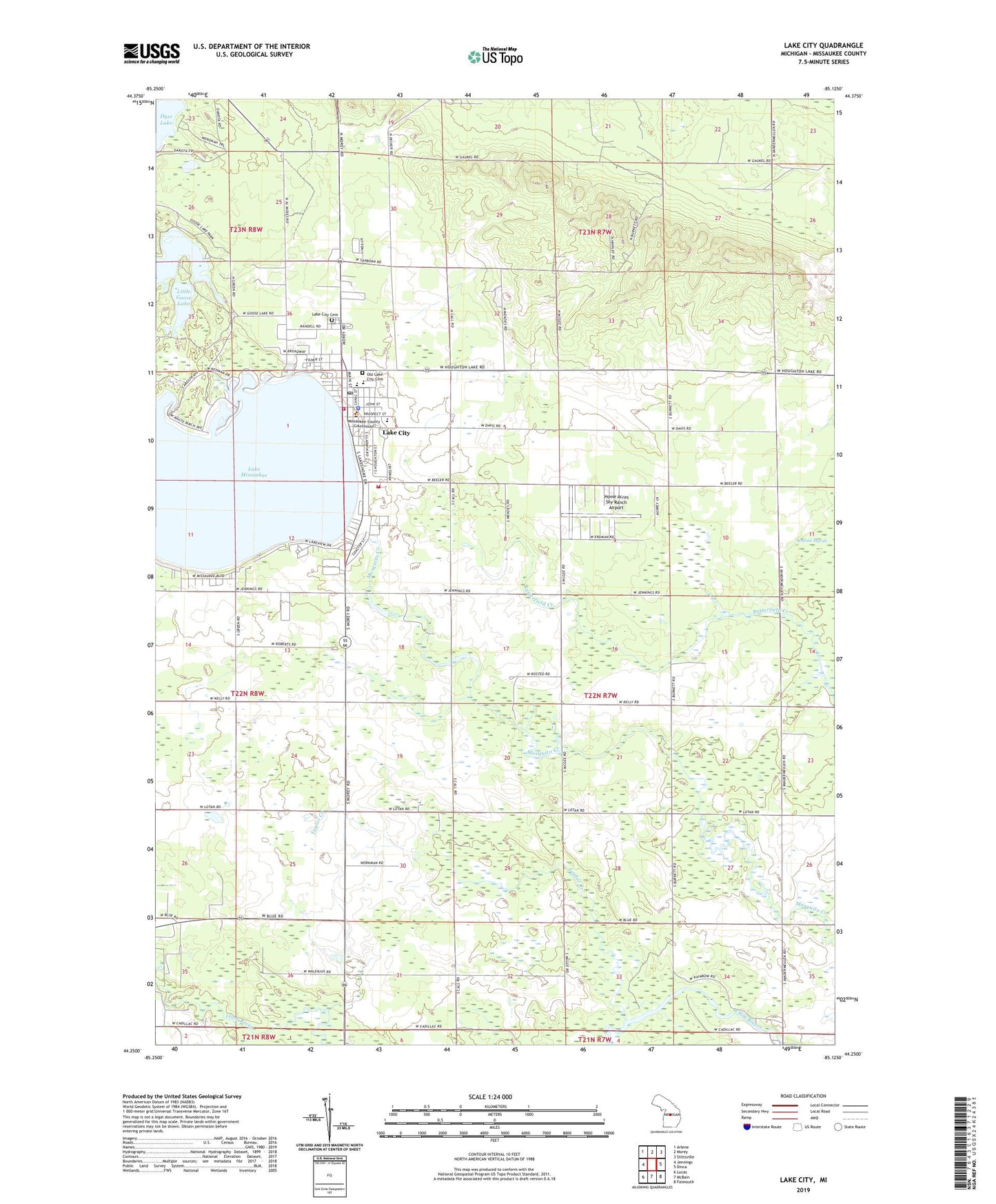
2023 topographic map quadrangle Lake City in the state of Michigan. Scale: 1:24000. Based on the newly updated USGS 7.5' US Topo map series, this map is in the following counties: Missaukee. The map contains contour data, water features, and other items you are used to seeing on USGS maps, but also has updated roads and other features. This is the next generation of topographic maps. Printed on high-quality waterproof paper with UV fade-resistant inks.
Quads adjacent to this one:
West: Jennings
Northwest: Arlene
North: Morey
Northeast: Stittsville
East: Dinca
Southeast: Falmouth
South: McBain
Southwest: Lucas
This map covers the same area as the classic USGS quad with code o44085c2.
Contains the following named places: Blind Lake, Calvary Baptist Church, Christian Reformed Church, City of Lake City, Covenant Life Church, Evangelical Presbyterian Church, First Presbyterian Church, Forest Township Hall, Free Methodist Church, Frey Post Office, Frey Station, Goose Lake, Goose Lake State Forest Campground, Home Acres Sky Ranch Airport, Kingdom Hall, Lake City, Lake City Area Fire Department, Lake City Assembly of God Church, Lake City Cemetery, Lake City High School, Lake City Middle School, Lake City Park, Lake City Post Office, Lake City Seventh Day Adventist Church, Lake City Southern Baptist Church, Lake City Station, Lake Missaukee, Lake Missaukee Area Fire Department, Lakeside School, Little Goose Lake, Maple Grove Park, Miltner Park, Missaukee County Courthouse, Missaukee County Emergency Medical Services Lake City, Missaukee County Park, Missaukee County Sheriff's Office, Missaukee District Library, Missaukee Golf Course, Northland Community Church, Old Lake City Cemetery, Reeder Hill Lookout Tower, Reeder Township Hall, Rose Lake, Saint Johns Church, Saint Stephens Catholic Church, Stoney Creek Golf Course, Taylor Creek, Township of Reeder, United Methodist Church