
MyTopo
Sturgis Michigan US Topo Map
Couldn't load pickup availability
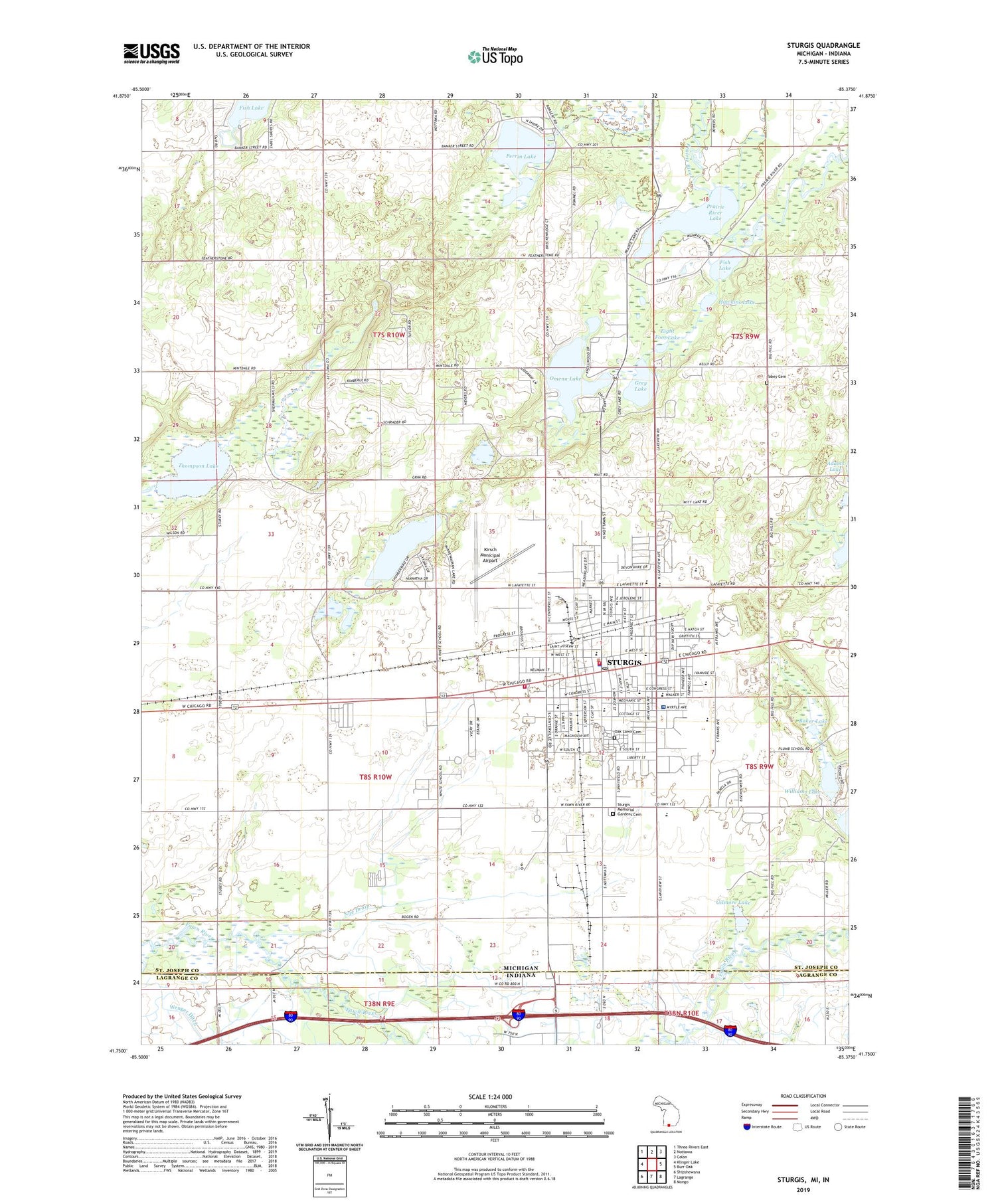
2019 topographic map quadrangle Sturgis in the states of Michigan, Indiana. Scale: 1:24000. Based on the newly updated USGS 7.5' US Topo map series, this map is in the following counties: St. Joseph, LaGrange. The map contains contour data, water features, and other items you are used to seeing on USGS maps, but also has updated roads and other features. This is the next generation of topographic maps. Printed on high-quality waterproof paper with UV fade-resistant inks.
Quads adjacent to this one:
West: Klinger Lake
Northwest: Three Rivers East
North: Nottawa
Northeast: Colon
East: Burr Oak
Southeast: Mongo
South: Lagrange
Southwest: Shipshewana
Contains the following named places: Arden Park School, Arthur Carl's Park, Baker Farms, Baker Lake, Benne Farm, Bogen School, Chapin Lake, Christian Fellowship Center, Church of Christ, Church of Jesus Christ of Latter Day Saints, Church of the Nazarene, City of Sturgis, Clark Farms, Clark Ranch, Community Bible Church, Congress Street School, Cornerstone Plaza, Eastwood School, Eight Foot Lake, Fawn River Farm, First Baptist Church, First Presbyterian Church, First United Methodist Church, Fish Lake, Fish Lake Church, Franks Park, Free Church Park, Gateway River of Life Church, Gilmore Lake, Grace Christian Fellowship, Green Valley Campground, Green Valley Golf Club, Grey Lake, Harmon Field, Hawkins Lake, Hiberlee School, Holy Angels Catholic Church, Holy Angels School, Howe-Lagrange Tollgate, Jerolene School, Kelley Farms, King Farms, Kingdom Hall of Jehovah's Witnesses, Kirsch Municipal Airport, Lake County Urology Clinic, Lakeside Farm, Langrick Street Park, Lighthouse Church, Maplecrest Plaza, Memorial Park, Memory Lane Mobile Home Park, Michiana Surgical Associates, Minnewaukan Lake, Nye Drain, Oak Lawn Cemetery, Oak Lawn Park, Old Depot Park, Omena Lake, Orange Cross Radiology, Park Street School, Perrin Lake, Pioneer Park, Plaza South, Potter's House Church, Prairie River Lake, Quirin Farm, Saint John's Episcopal Church, Saint Johns Lutheran Church, Saint John's Lutheran School, Shadowlawn Park, Sherman Township Hall, Spence Field, Sturgis, Sturgis Baptist Church, Sturgis Bible Church, Sturgis Christian School, Sturgis City Hall, Sturgis Evangelical Church, Sturgis Fire Department, Sturgis Foot and Ankle Clinic, Sturgis Foursquare Church, Sturgis Health Care, Sturgis High School, Sturgis Historical Society Museum, Sturgis Hospital, Sturgis Hospital Specialty Center, Sturgis Memorial Gardens, Sturgis Middle School, Sturgis Missionary Church, Sturgis Pediatrics Clinic, Sturgis Plaza, Sturgis Police Department, Sturgis Post Office, Sturgis Public Library, Sturgis Training Center, Thompson Lake, Thurston Woods Park, Tobey Cemetery, Tower Plaza, Township of Sherman, Township of Sturgis, Tri - Township Fire Department, Trinity Lutheran Church, Trinity Lutheran School, Wenger Ditch, Wenzel School, Wesleyan Church, White School, Whole Life Christian Fellowship, Williams Lake, WMSH-AM (Sturgis), WMSH-FM (Sturgis), ZIP Code: 49091


