MyTopo
Shipshewana Indiana US Topo Map
Couldn't load pickup availability
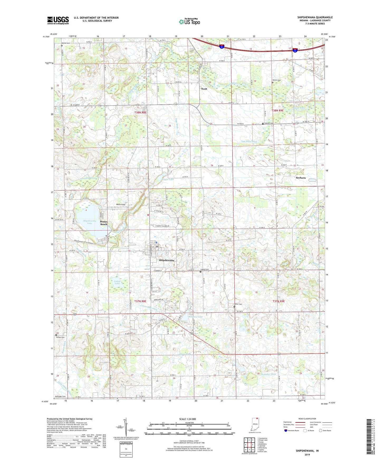
2022 topographic map quadrangle Shipshewana in the state of Indiana. Scale: 1:24000. Based on the newly updated USGS 7.5' US Topo map series, this map is in the following counties: LaGrange. The map contains contour data, water features, and other items you are used to seeing on USGS maps, but also has updated roads and other features. This is the next generation of topographic maps. Printed on high-quality waterproof paper with UV fade-resistant inks.
Quads adjacent to this one:
West: Middlebury
Northwest: Constantine
North: Klinger Lake
Northeast: Sturgis
East: Lagrange
Southeast: Oliver Lake
South: Topeka
Southwest: Millersburg
This map covers the same area as the classic USGS quad with code o41085f5.
Contains the following named places: Barton Cemetery, Beatys Beach, Bethel Cemetery, Cotton Lake, Cotton Lake Ditch, Farver Ditch, Fetch Ditch, Haarer Ditch, Hostetler Ditch, Huff School, Lima Church, Lupold Cemetery, Marion Church, Miller Cemetery, Page Ditch, Pashan Cemetery, Pashan School, Rainbow Lake, Scott, Scott Mill Pond Public Fishing Area, Seyberts, Shipshewana, Shipshewana Lake, Shipshewana Police Department, Shipshewana Post Office, Shipshewana Volunteer Fire Department, Shipshewana-Scott Elementary School, Shore Church, Sidener Cemetery, Taylor Lake, Town of Shipshewana, Township of Newbury, Township of Van Buren, Truesdale Ditch, United Brethren Camp, Van Natta Ditch, Wolfe Field, Yoder School, ZIP Code: 46565