MyTopo
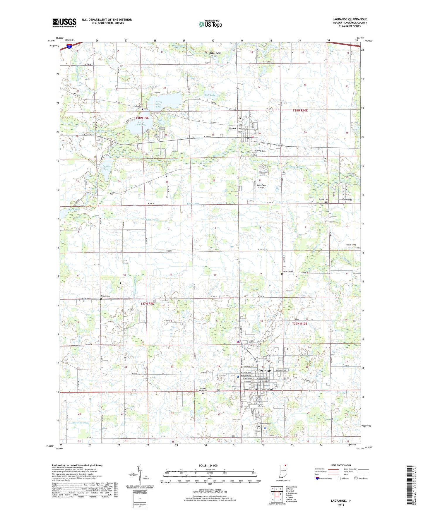
Lagrange Indiana US Topo Map
Couldn't load pickup availability
2022 topographic map quadrangle Lagrange in the state of Indiana. Scale: 1:24000. Based on the newly updated USGS 7.5' US Topo map series, this map is in the following counties: LaGrange. The map contains contour data, water features, and other items you are used to seeing on USGS maps, but also has updated roads and other features. This is the next generation of topographic maps. Printed on high-quality waterproof paper with UV fade-resistant inks.
Quads adjacent to this one:
West: Shipshewana
Northwest: Klinger Lake
North: Sturgis
Northeast: Burr Oak
East: Mongo
Southeast: Wolcottville
South: Oliver Lake
Southwest: Topeka
This map covers the same area as the classic USGS quad with code o41085f4.
Contains the following named places: Bethel Cemetery, Buck Creek, Buck Lake, Church of Christ, County Farm Cemetery, Creekside School, East Buck Creek Ditch, East Fly Creek, First Church of God, First Methodist Church, Fly Creek, Green School, Greenwood Cemetery, Hoagland Cemetery, Howe, Howe Census Designated Place, Howe Military Academy, Howe Post Office, Howe Volunteer Fire Department, Indian Trail School, Lagrange, Lagrange Country Club, LaGrange County, LaGrange County Ambulance, LaGrange County Sheriff Department, LaGrange Fire Department, LaGrange Police Department, LaGrange Post Office, Lakeland High School, Lakeland Junior High, Lakeland Junior High School, Lima-Brighton Elementary School, Maple Grove School, McCoy Cemetery, McManus Ditch, Mount Zion Lutheran Church, New Life Assembly of God, North Twin Lake, Northwood, Ontario, Ontario Cemetery, Ontario Community Church, Ontario Park, Parkside Elementary School, Parkview LaGrange Hospital, Pigeon Lake, Pleasant Acre School, Reid-Eash Airport, River Oaks, Riverside Cemetery, Rowe Ditch, Saint Marks Episcopal Church, South Twin Lake, Star Mill, Still Lake, Stoner Ditch, Town of Lagrange, Township of Clay, Township of Lima, Twin Lakes, Twin Lakes Cemetery, Woodland Hills, Woodside School, ZIP Code: 46761


