MyTopo
Sullivan Michigan US Topo Map
Couldn't load pickup availability
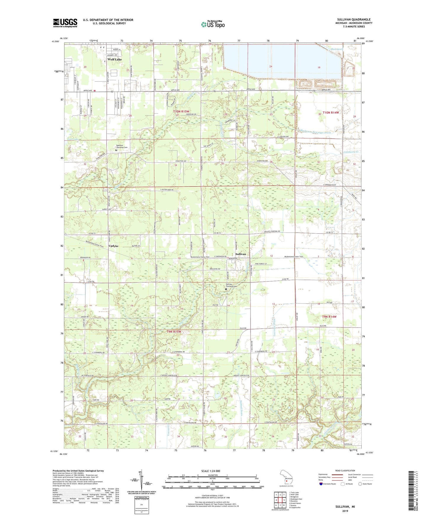
2019 topographic map quadrangle Sullivan in the state of Michigan. Scale: 1:24000. Based on the newly updated USGS 7.5' US Topo map series, this map is in the following counties: Muskegon. The map contains contour data, water features, and other items you are used to seeing on USGS maps, but also has updated roads and other features. This is the next generation of topographic maps. Printed on high-quality waterproof paper with UV fade-resistant inks.
Quads adjacent to this one:
West: Muskegon East
Northwest: Twin Lake
North: Wolf Lake
Northeast: Bridgeton
East: Ravenna
Southeast: Coopersville
South: Nunica
Southwest: Grand Haven
Contains the following named places: Apple Carr Village, Bates School, Beacon Light Community Church, Cranberry Creek, Egelston Township Cemetery, Egelston Township Fire Department, Hall Drain, Jibson Church, Jibson School, Lawrence Drain, Light of Hope Chapel, Muskegon County Wastewater Management System, Muskegon Newaygo Drain, Oakridge High School, Oakridge Middle School, Ravenna School, Sanford Drain, Sullivan, Sullivan Community Church, Sullivan Post Office, Sullivan Station, Sullivan Township Cemetery, Township of Egelston, Township of Sullivan, Updyke, WMUS-FM (Muskegon), Wolf Lake Census Designated Place, Wolf Lake Church, WSNX-FM (Muskegon), ZIP Code: 49415