MyTopo
Bridgeton Michigan US Topo Map
Couldn't load pickup availability
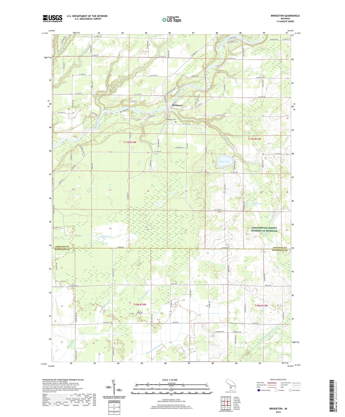
2023 topographic map quadrangle Bridgeton in the state of Michigan. Scale: 1:24000. Based on the newly updated USGS 7.5' US Topo map series, this map is in the following counties: Newaygo, Muskegon. The map contains contour data, water features, and other items you are used to seeing on USGS maps, but also has updated roads and other features. This is the next generation of topographic maps. Printed on high-quality waterproof paper with UV fade-resistant inks.
Quads adjacent to this one:
West: Wolf Lake
Northwest: Holton
North: Fremont
Northeast: Newaygo
East: Grant
Southeast: Casnovia
South: Ravenna
Southwest: Sullivan
This map covers the same area as the classic USGS quad with code o43085c8.
Contains the following named places: Bixby Post Office, Blood Lake, Bowen School, Bridgeton, Bridgeton Church, Bridgeton Post Office, Bridgeton Township Cemetery, Brigadoon Golf Club, Chinook Campground, Community Fellowship Church, Dailey Drain, Dickenson School, Dickinson Post Office, Dickinson Station, Ferguson School, Indian Run, Johnston School, Lewis Drain, McLean, McLean School, McLeans Post Office, Minnie Creek, Sand Creek, Sand Lake, Slater Drain, Streams Airpark, Township of Bridgeton, Trent Post Office, Trent School, WZZM-TV (Grand Rapids)