MyTopo
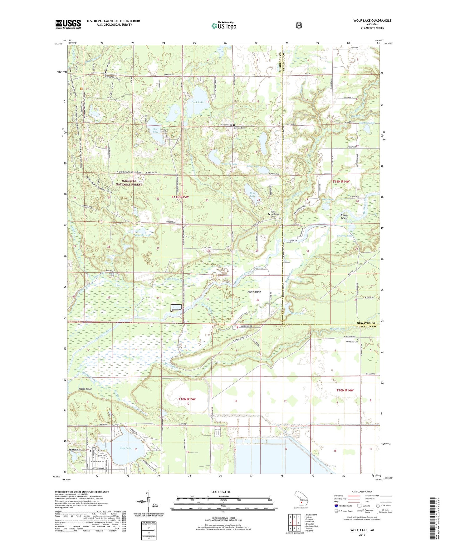
Wolf Lake Michigan US Topo Map
Couldn't load pickup availability
Also explore the Wolf Lake Forest Service Topo of this same quad for updated USFS data
2023 topographic map quadrangle Wolf Lake in the state of Michigan. Scale: 1:24000. Based on the newly updated USGS 7.5' US Topo map series, this map is in the following counties: Muskegon, Newaygo. The map contains contour data, water features, and other items you are used to seeing on USGS maps, but also has updated roads and other features. This is the next generation of topographic maps. Printed on high-quality waterproof paper with UV fade-resistant inks.
Quads adjacent to this one:
West: Twin Lake
Northwest: Big Blue Lake
North: Holton
Northeast: Fremont
East: Bridgeton
Southeast: Ravenna
South: Sullivan
Southwest: Muskegon East
This map covers the same area as the classic USGS quad with code o43086c1.
Contains the following named places: Baker Lake, Brooks Creek, Camp Pinewood, Camp Tocanja, Cedar Creek Church, Cedar Creek Cycle Trail, Cedar Creek Evangelical Church, Chidester Cemetery, Clear Lake, Cow Creek, Duck Lake, Echo Lake, Evans School, Graham Creek, Halverson Lake, Hendrickson Lake, Indian Cemetery, Indian Point, Jibson School, John F Kennedy Memorial Park, Johnson Cemetery, Little Cedar Creek, Little Henna Creek, Maple Island, Maple Island Estates Mobile Home Park, Maple Island School, Maple Lake, Maple River, Michigan Department of Natural Resources Muskegon Field Office, Mosquito Creek, Muskrat Lake, Mystery Lake, Palmer School, Ryerson School, Saint Anthonys Cemetery, Schaffer Lake, Spring Creek, Sweeter Creek, Sweeter Lake, Sweeter Post Office, Township of Cedar Creek, Troque Island, Truckey Lake, Wolf Lake, Wolf Lake County Park, Wolf Lake Resort and Campground, Wolf Lake United Methodist Church