MyTopo
Perrinton Michigan US Topo Map
Couldn't load pickup availability
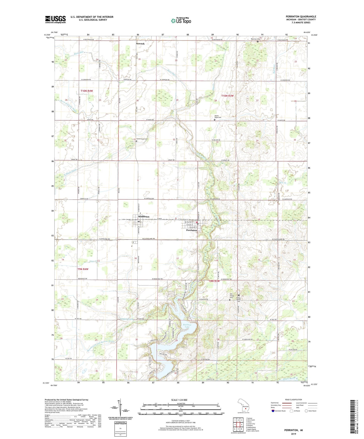
2023 topographic map quadrangle Perrinton in the state of Michigan. Scale: 1:24000. Based on the newly updated USGS 7.5' US Topo map series, this map is in the following counties: Gratiot. The map contains contour data, water features, and other items you are used to seeing on USGS maps, but also has updated roads and other features. This is the next generation of topographic maps. Printed on high-quality waterproof paper with UV fade-resistant inks.
Quads adjacent to this one:
West: Carson City
Northwest: Sumner
North: Alma South
Northeast: Ithaca
East: Pompeii
Southeast: Saint Johns North
South: Maple Rapids
Southwest: Hubbardston
This map covers the same area as the classic USGS quad with code o43084b6.
Contains the following named places: Abundant Life Christian Church, Beechler Cemetery, Casteel Drain, Country Side Christian School, Double Eagle Dairy, Fulton Center Cemetery, Fulton Center Church, Fulton Church, Fulton High School, Greenwood Cemetery, Hayes Road Cemetery, Maple Rapids United Methodist Church, Marantha United Brethren Church, Middleton, Middleton Post Office, Middleton Station, Myra and Coly Drain, New Haven Church, Newark, Newark Drain, Newark Post Office, Newark-Mennonite Church, Old Fulton Cemetery, Otter Creek, Overbrook Golf Course, Perrington United Methodist Church, Perrinton, Perrinton Fire Department, Perrinton Post Office, Perrinton Station, Rainbow Lake, River Styx, Spring Brook Post Office, Stonebrook and Harlow Drain, Township of Fulton, Township of Newark, Village of Perrinton, Wildwood Mennonite Church, ZIP Codes: 48856, 48871