MyTopo
Thornville Michigan US Topo Map
Couldn't load pickup availability
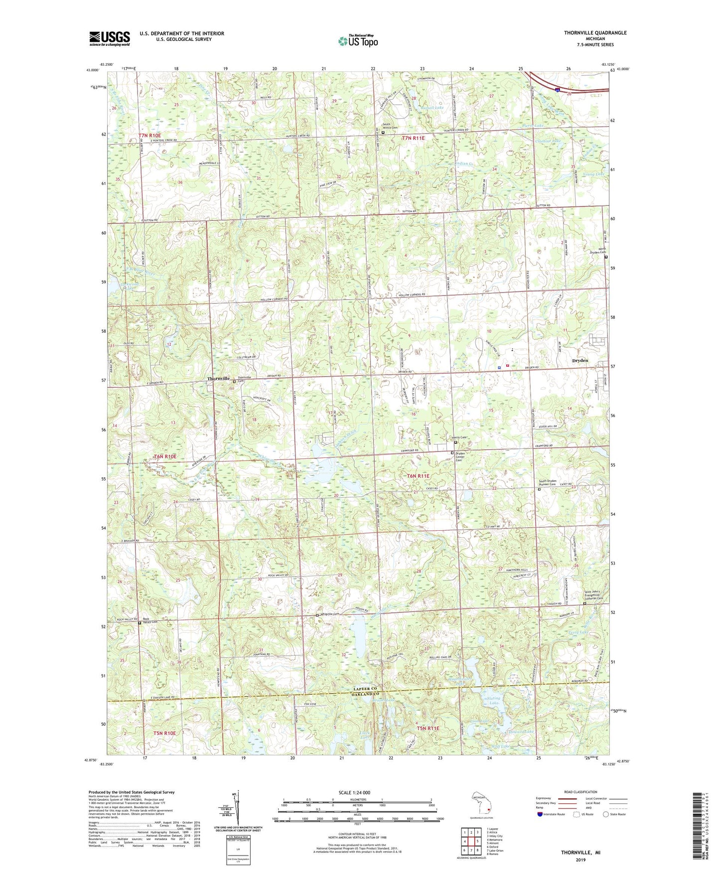
2023 topographic map quadrangle Thornville in the state of Michigan. Scale: 1:24000. Based on the newly updated USGS 7.5' US Topo map series, this map is in the following counties: Lapeer, Oakland. The map contains contour data, water features, and other items you are used to seeing on USGS maps, but also has updated roads and other features. This is the next generation of topographic maps. Printed on high-quality waterproof paper with UV fade-resistant inks.
Quads adjacent to this one:
West: Metamora
Northwest: Lapeer
North: Attica
Northeast: Imlay City
East: Almont
Southeast: Romeo
South: Lake Orion
Southwest: Oxford
This map covers the same area as the classic USGS quad with code o42083h2.
Contains the following named places: Bethel Baptist Church, Brooks Lake, Caldecott Park, Clack Lake, Cluebine Lake, D Bar A Scout Ranch, Dollar Pond, Dryden Center Cemetery, Dryden High School, Dryden Township Fire Department Station 2, Dryden Township Library, Dryden Township Police Department, Dryden United Methodist Church, General Squire Memorial Park, General Squire Park Historical Marker, Hagemeister Lake, Harris Cemetery, Holy Redeemer Lutheran Church, Howard Lake, Indian Creek, Ladies Library Hall Historical Marker, Little Lake, Lockwood Lake, Long Lake Drain, Loon Lake, Mud Lake, North Dryden Cemetery, Peters Lake, Pierce Lake, Pool Post Office, Rock Valley Cemetery, Russell Lake, Saint Cornelius Church, Saint Johns Episcopal Church, Saint John's Evangelical Lutheran Cemetery, Sanborn Drain, Seven Ponds Lake, Seven Ponds Nature Center, Slating Lake, South Attica Cemetery, Terry Lake, Thornville, Thornville Baptist Church, Thornville Cemetery, Thornville Post Office, Township of Dryden, Whigville Cemetery, Whigville Creek, Whigville Lake, Whigville Post Office, Wolf Lake, Wright Cemetery, ZIP Code: 48428