
MyTopo
Tie Lake Michigan US Topo Map
Couldn't load pickup availability
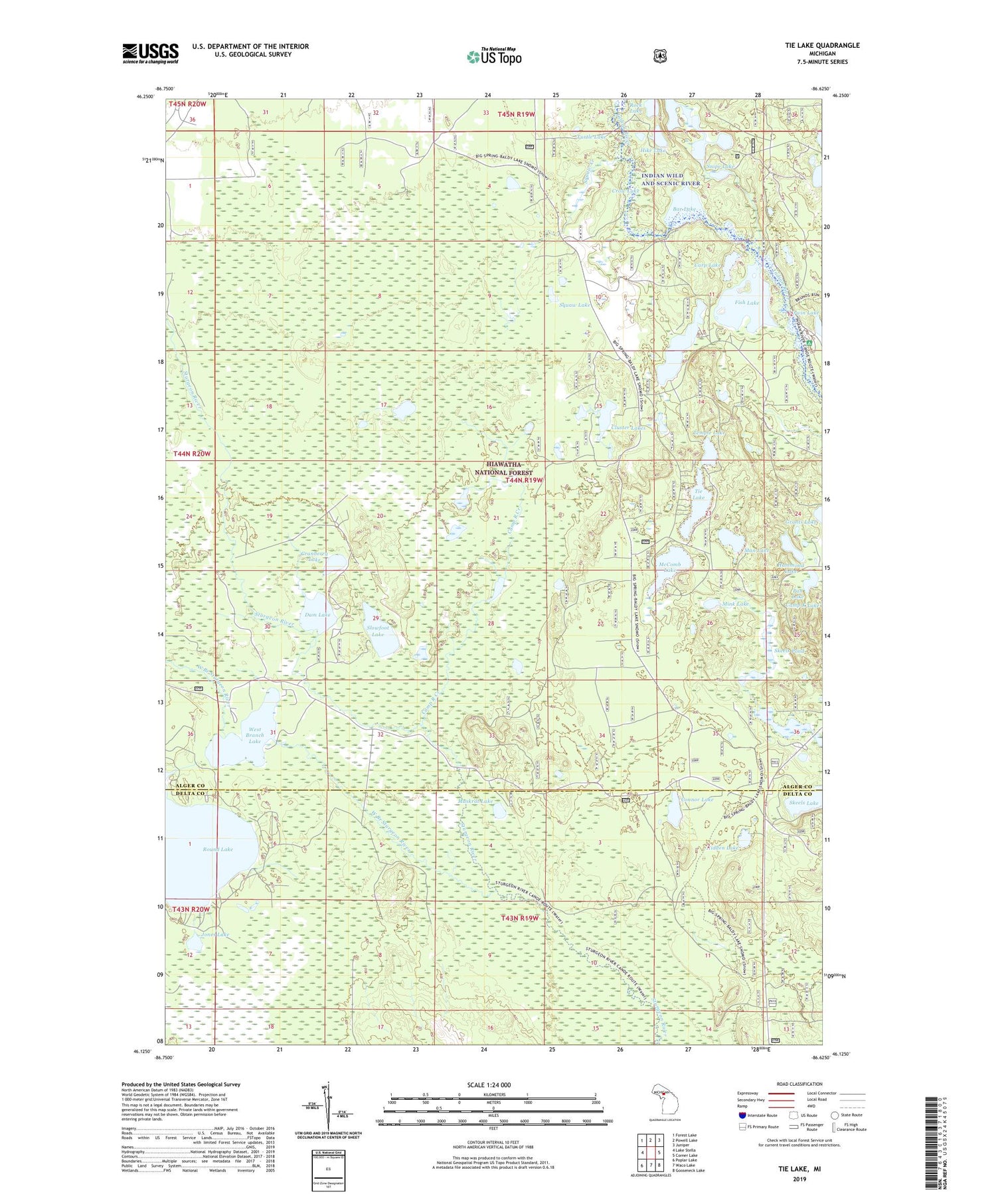
2019 topographic map quadrangle Tie Lake in the state of Michigan. Scale: 1:24000. Based on the newly updated USGS 7.5' US Topo map series, this map is in the following counties: Alger, Delta. The map contains contour data, water features, and other items you are used to seeing on USGS maps, but also has updated roads and other features. This is the next generation of topographic maps. Printed on high-quality waterproof paper with UV fade-resistant inks.
Quads adjacent to this one:
West: Lake Stella
Northwest: Forest Lake
North: Powell Lake
Northeast: Juniper
East: Corner Lake
Southeast: Gooseneck Lake
South: Waco Lake
Southwest: Poplar Lake
Contains the following named places: Baldy Lake, Bar Lake, Blue Lake, Camp R Creek, Camp Red Buck, Carp Lake, Cluster Lakes, Connor Lake, Council Lake, Cranberry Lake, Crow Lake, Dam Lake, Fish Lake, Hammond Lake, Hidden Lake, Hike Lake, Irwin Lake, Jones Lake, Lion Lake, Man Lake, McComb Lake, Mink Lake, Muskrat Lake, Pan Lake, Red Jack Lake, Rock Lake, Round Lake, Scout Lake, Skeels Lake, Skeels Pond, Slowfoot Lake, Snipe Lake, Squaw Creek, Squaw Lake, Squaw Ponds, Temple Lake, Tie Hill Lookout Tower, Tie Lake, Turtle Lake, West Branch Lake, West Branch Sturgeon River, Wide Water Campground, ZIP Code: 49895


