MyTopo
Corner Lake Michigan US Topo Map
Couldn't load pickup availability
Also explore the Corner Lake Forest Service Topo of this same quad for updated USFS data
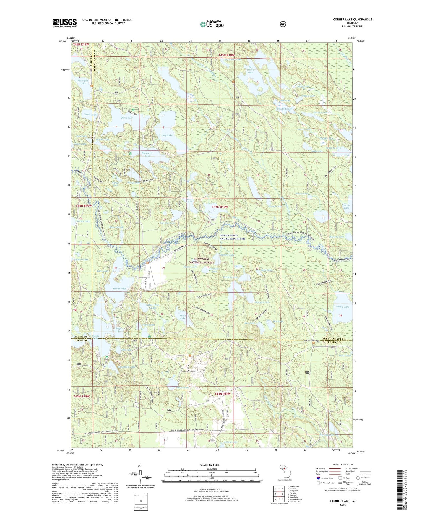
2023 topographic map quadrangle Corner Lake in the state of Michigan. Scale: 1:24000. Based on the newly updated USGS 7.5' US Topo map series, this map is in the following counties: Schoolcraft, Delta, Alger. The map contains contour data, water features, and other items you are used to seeing on USGS maps, but also has updated roads and other features. This is the next generation of topographic maps. Printed on high-quality waterproof paper with UV fade-resistant inks.
Quads adjacent to this one:
West: Tie Lake
Northwest: Powell Lake
North: Juniper
Northeast: Shingleton
East: Steuben
Southeast: Thunder Lake
South: Gooseneck Lake
Southwest: Waco Lake
This map covers the same area as the classic USGS quad with code o46086b5.
Contains the following named places: Big Island Lake, Big Island Lake Portage Canoe Trail, Big Island Lake Wilderness, Blue Joe Lake, Brevick Lake, Camp K Lake, Center Lake, Coattail Lake, Cookson Lake, Corner Lake, Corner Lake Recreation Area, Corner Lake Recreation Park, Cucumber Lake, Deep Lake, Deer Creek, Dinner Lake, Dipper Lake, Grants Lake, Grassy Creek, Grassy Lake, Green Bass Lake, Herman Lake, Hub Lake, Hugoboom Lake, Ironjaw Lake, Kimble Lake, Klondike Lake, Little Indian River, Little Island Lake, Little Lake, McInnes Lake, McKeever Lake, Mid Lake, Mike White Lake, Moccasin Lake, Moccasin Lake Picnic Area, Mowe Lake, Neds Lake, Nineteen Lake, Norway Lake, Onega Lake, Ostrander Lake, Peanut Lake, Petes Lake, Petes Lake Recreation Area, Pewee Lake, Pike Lake, Red Lake, Rim Lake, River Slough, Rumble Lake, Spot Lake, Sprinkler Lake, Spud Lake, Straits Lake, Stueben Landing Field, Swamp Lake, Swan Lake, Thornton Lake, Toms Lake, Town Lake, Townline Lake, Tri - County Volunteer Fire Department, Triangle Lake, Uno Post Office, Upper Lake, Vance Lake, Verdant Lake, Wedge Lake