MyTopo
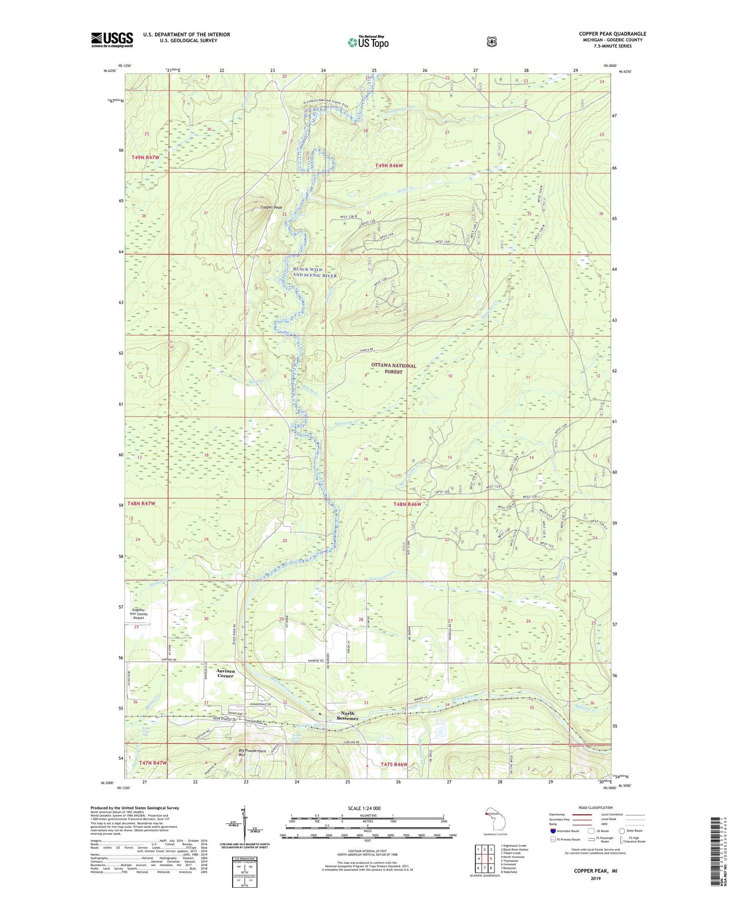
Copper Peak Michigan US Topo Map
Couldn't load pickup availability
Also explore the Copper Peak Forest Service Topo of this same quad for updated USFS data
2023 topographic map quadrangle Copper Peak in the state of Michigan. Scale: 1:24000. Based on the newly updated USGS 7.5' US Topo map series, this map is in the following counties: Gogebic. The map contains contour data, water features, and other items you are used to seeing on USGS maps, but also has updated roads and other features. This is the next generation of topographic maps. Printed on high-quality waterproof paper with UV fade-resistant inks.
Quads adjacent to this one:
West: North Ironwood
Northwest: Nighthawk Creek
North: Black River Harbor
Northeast: Tiebel Creek
East: Thomaston
Southeast: Wakefield
South: Bessemer
Southwest: Ironwood
This map covers the same area as the classic USGS quad with code o46090e1.
Contains the following named places: Abitosse Creek, Algonquin Falls, Auvinen Corner, Big Powderhorn Mountain, Black Wild and Scenic River, Boulder Creek Golf Course, Cameron Run Ski Trail, Cameron Spur Ski Trail, Chippewa Falls, Copper Peak, Copper Peak: Chippewa Hill Historical Marker, Dukes Mixture Ski Trail, Gladders Ski Trail, Greys Creek, Horseshoe Ski Trail, Kallander Creek, Kirby Creek, Log Jam Ski Trail, Molessa County Park, Montowibo Creek, Narrows Creek, No Name Ski Trail, North Bessemer, North Bessemer School, Powder Horn Falls, Powder Mill Creek, Reed Creek, Rocky Forty Falls, Sand Island Creek, Sapsucker Creek, Siemens Creek, Sixmile Creek, Spillway Ski Trail, Whelp Creek, Whitesides Crossing Ski Trail