MyTopo
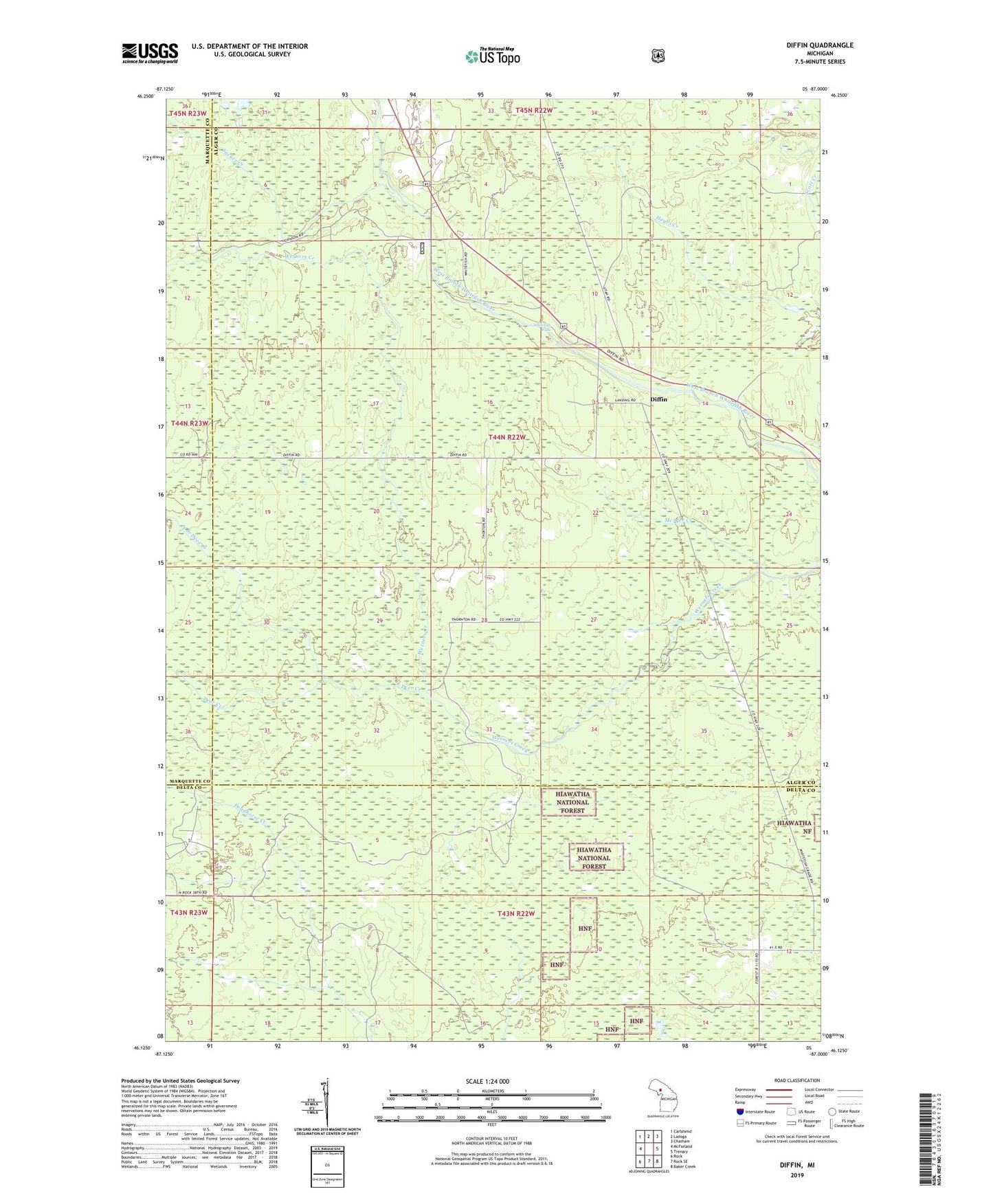
Diffin Michigan US Topo Map
Couldn't load pickup availability
Also explore the Diffin Forest Service Topo of this same quad for updated USFS data
2023 topographic map quadrangle Diffin in the state of Michigan. Scale: 1:24000. Based on the newly updated USGS 7.5' US Topo map series, this map is in the following counties: Alger, Delta, Marquette. The map contains contour data, water features, and other items you are used to seeing on USGS maps, but also has updated roads and other features. This is the next generation of topographic maps. Printed on high-quality waterproof paper with UV fade-resistant inks.
Quads adjacent to this one:
West: McFarland
Northwest: Carlshend
North: Ladoga
Northeast: Chatham
East: Trenary
Southeast: Baker Creek
South: Rock SE
Southwest: Rock
This map covers the same area as the classic USGS quad with code o46087b1.
Contains the following named places: Deer Creek, Diffin, Hughitt Camp, Mantila Camp, McAfee Creek, North Branch Deer Creek, Sucker Creek, Township of Limestone, Whitefish Falls, ZIP Code: 49891