MyTopo
Saunders Creek Michigan US Topo Map
Couldn't load pickup availability
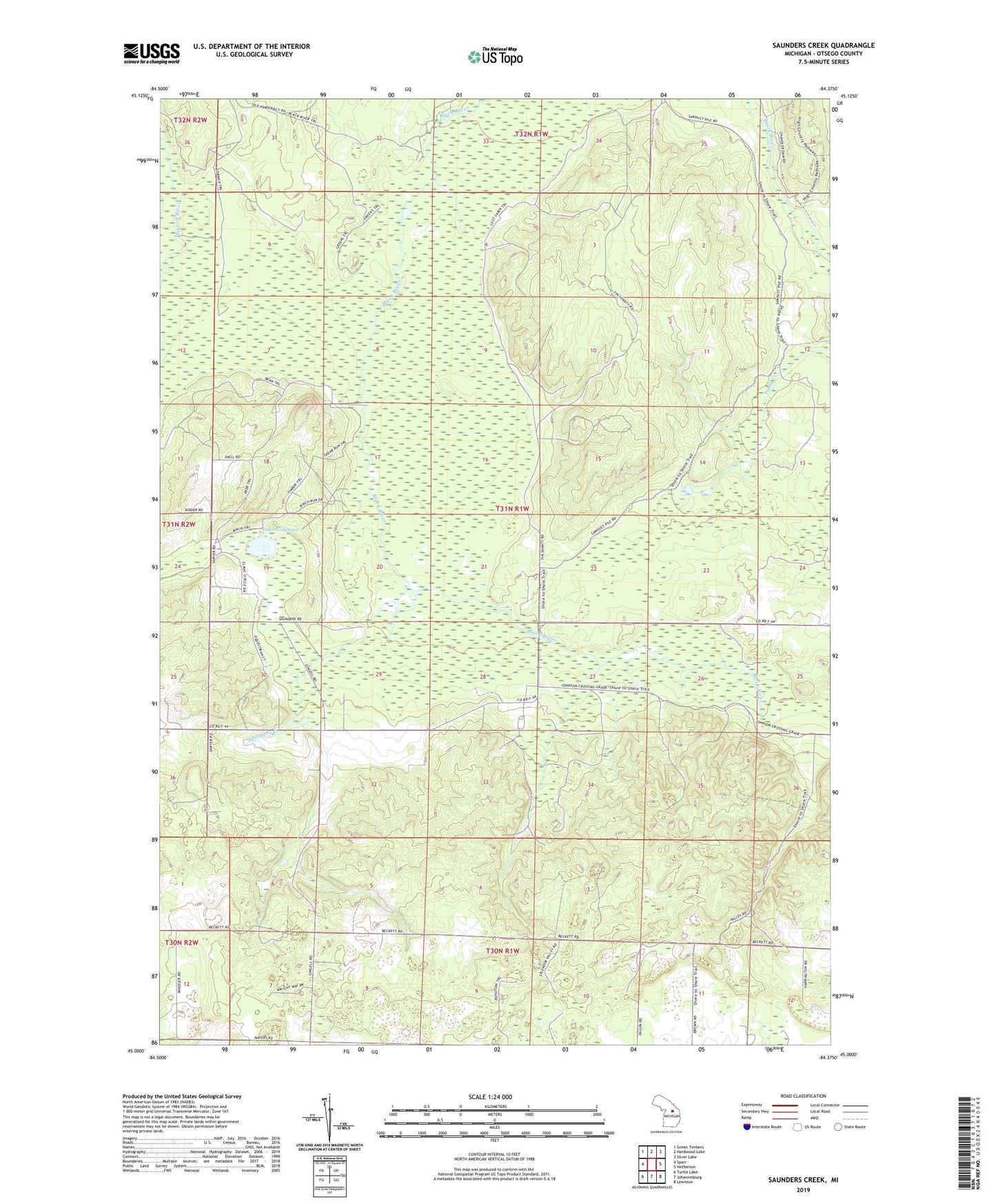
2023 topographic map quadrangle Saunders Creek in the state of Michigan. Scale: 1:24000. Based on the newly updated USGS 7.5' US Topo map series, this map is in the following counties: Otsego. The map contains contour data, water features, and other items you are used to seeing on USGS maps, but also has updated roads and other features. This is the next generation of topographic maps. Printed on high-quality waterproof paper with UV fade-resistant inks.
Quads adjacent to this one:
West: Sparr
Northwest: Green Timbers
North: Hardwood Lake
Northeast: Silver Lake
East: Hetherton
Southeast: Lewiston
South: Johannesburg
Southwest: Turtle Lake
This map covers the same area as the classic USGS quad with code o45084a4.
Contains the following named places: Lake Nineteen, Metzger School, Saunders Creek, Saunders Dam