MyTopo
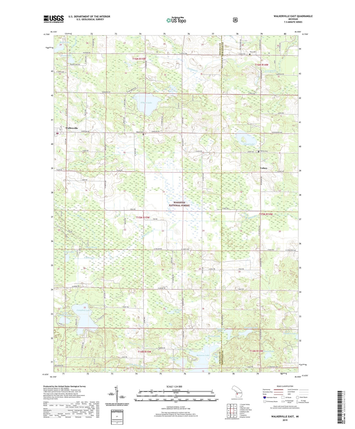
Walkerville East Michigan US Topo Map
Couldn't load pickup availability
2019 topographic map quadrangle Walkerville East in the state of Michigan. Scale: 1:24000. Based on the newly updated USGS 7.5' US Topo map series, this map is in the following counties: Oceana, Newaygo. The map contains contour data, water features, and other items you are used to seeing on USGS maps, but also has updated roads and other features. This is the next generation of topographic maps. Printed on high-quality waterproof paper with UV fade-resistant inks.
Quads adjacent to this one:
West: Walkerville West
Northwest: Crystal Valley
North: Carr
Northeast: Big Star Lake
East: Walkup Lake
Southeast: Dayton Center
South: Hesperia
Southwest: Ferry
Contains the following named places: Abson Cemetery, Bar Lake, Beaver Post Office, Bird Post Office, Black Lake, Butternut Lake, Campbell Lake, Colfax, Fairchild Lake, Gilbert Lake, Gilbert Lake Oil Field, Huber Oil Field, Island Lake, Klondike Post Office, Little Campbell Lake, McGann Lake, McLaren Lake, McLeam Lake, Mountain Lake, Rossel Lake, Sorter Lake, South Beaver Creek, Tanner Swamp, Tourcotte Lake, Township of Leavitt, Troy, Troy Cemetery, Volney, Volney Bible Church, Volney Cemetery, Volney Post Office, Volney School, Walkerville, Walkerville Area Fire and Rescue, Walkerville Elementary School, Walkerville High School, Walkerville Police Department, Walkerville Post Office, Walkerville Station, Walkerville United Methodist Church, Walkerville Wesleyan Church, ZIP Code: 49459