MyTopo
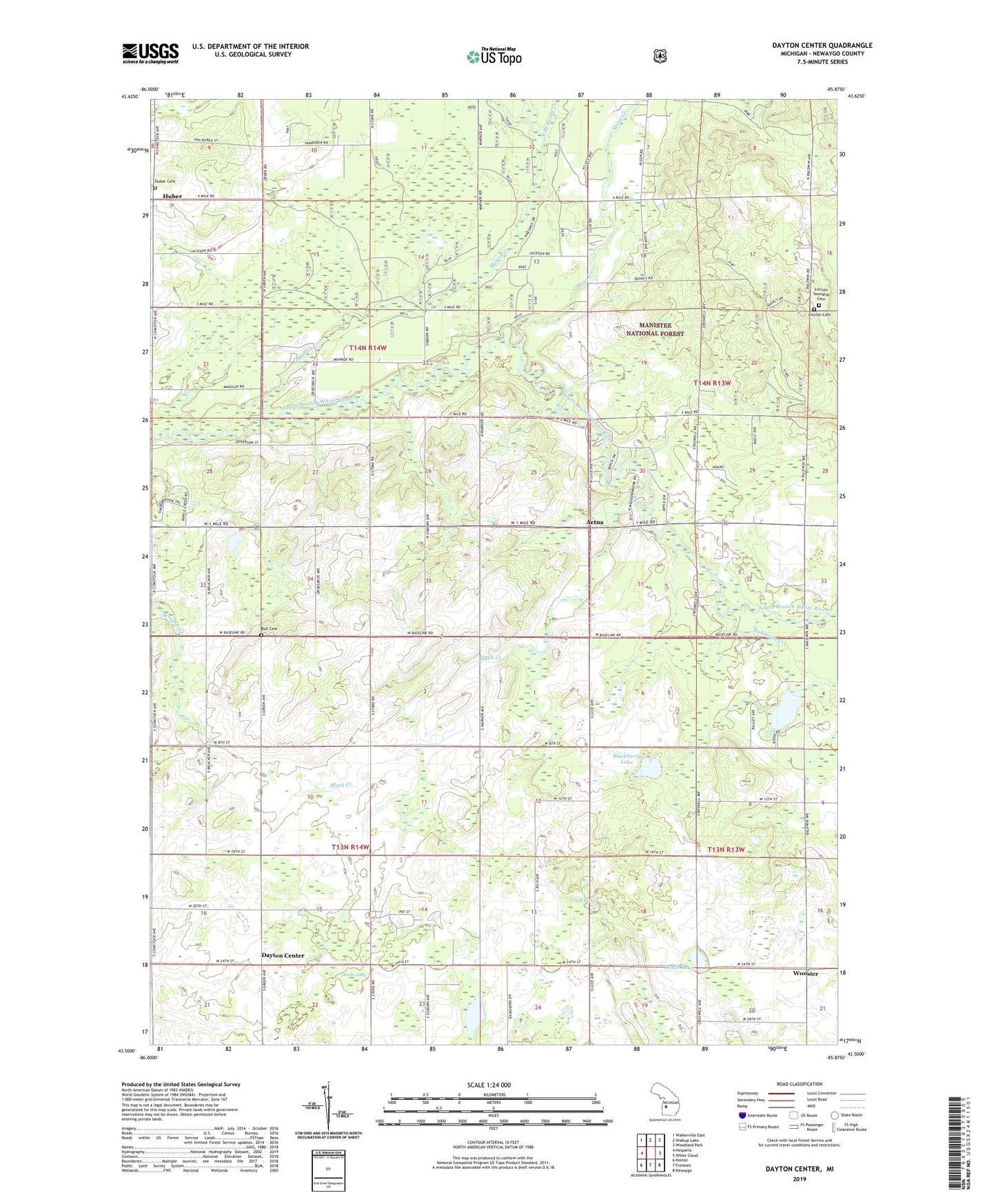
Dayton Center Michigan US Topo Map
Couldn't load pickup availability
Also explore the Dayton Center Forest Service Topo of this same quad for updated USFS data
2023 topographic map quadrangle Dayton Center in the state of Michigan. Scale: 1:24000. Based on the newly updated USGS 7.5' US Topo map series, this map is in the following counties: Newaygo. The map contains contour data, water features, and other items you are used to seeing on USGS maps, but also has updated roads and other features. This is the next generation of topographic maps. Printed on high-quality waterproof paper with UV fade-resistant inks.
Quads adjacent to this one:
West: Hesperia
Northwest: Walkerville East
North: Walkup Lake
Northeast: Woodland Park
East: White Cloud
Southeast: Newaygo
South: Fremont
Southwest: Holton
This map covers the same area as the classic USGS quad with code o43085e8.
Contains the following named places: Aetna, Aetna Calvary Church, Aetna Post Office, Black Creek, Blackberry Lake, Bull Cemetery, Clarks Lake, Cook Lake, Country Bible Church, Dayton Center, Dayton Center Wesleyan Church, Denver Post Office, Denver School, Devils Lake, Donahue School, Dutch Lake, East Branch Heald Creek, East Denver Church, Gilbert Drain, Graham School, Harold T Rice Park, Huber, Huber Cemetery, Huber Post Office, Koopman Drain, Lincoln Township Cemetery, Martin Creek, Mena Creek, Northwood Golf Course, Peterson Lake, Robinson Creek, Township of Dayton, Township of Denver, Walker School, West Branch Heald Creek, Willcox Post Office