MyTopo
Walkup Lake Michigan US Topo Map
Couldn't load pickup availability
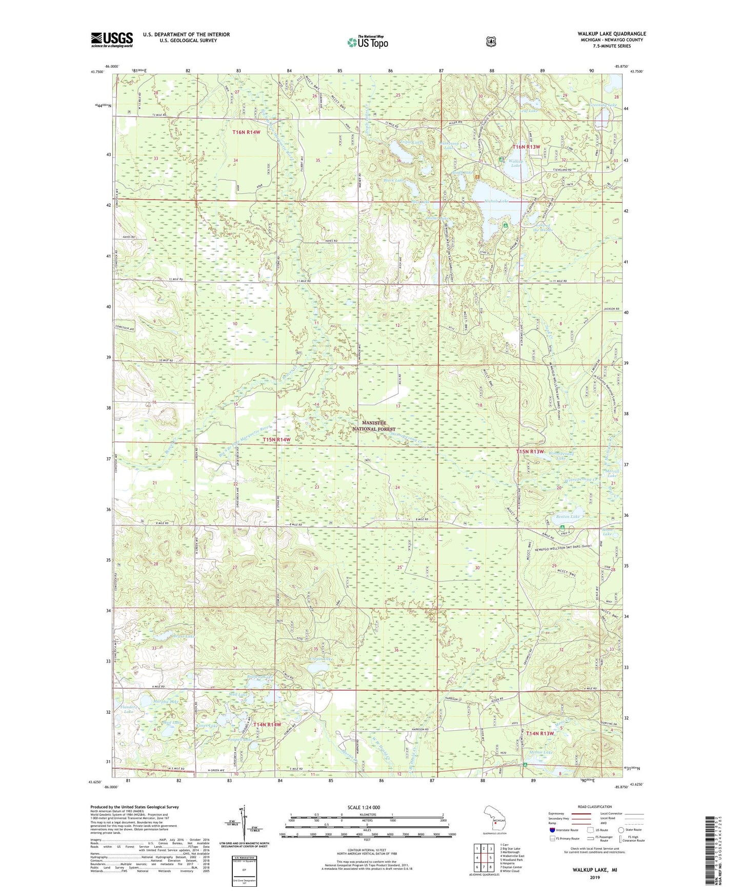
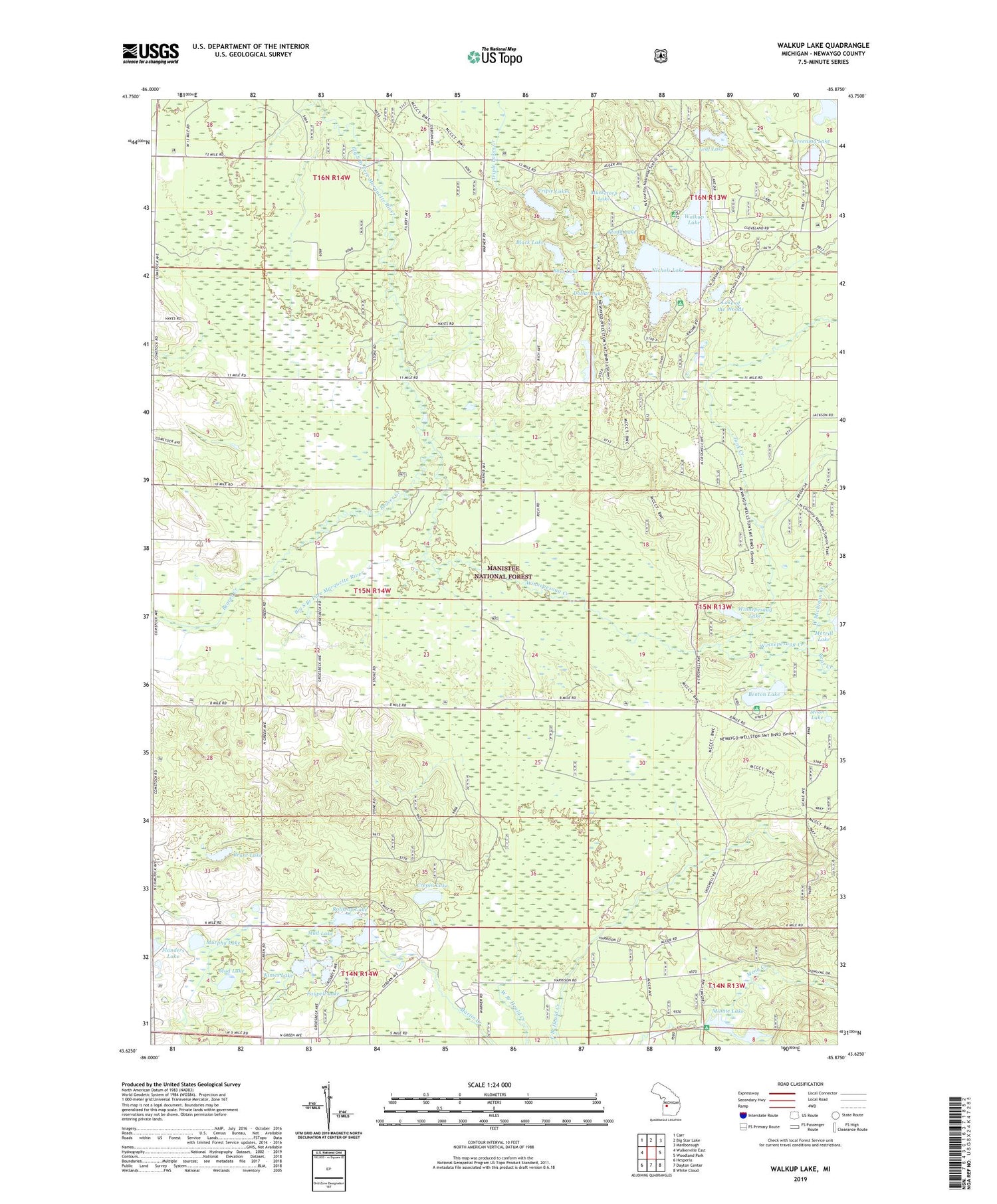
2019 topographic map quadrangle Walkup Lake in the state of Michigan. Scale: 1:24000. Based on the newly updated USGS 7.5' US Topo map series, this map is in the following counties: Newaygo. The map contains contour data, water features, and other items you are used to seeing on USGS maps, but also has updated roads and other features. This is the next generation of topographic maps. Printed on high-quality waterproof paper with UV fade-resistant inks.
Quads adjacent to this one:
West: Walkerville East
Northwest: Carr
North: Big Star Lake
Northeast: Marlborough
East: Woodland Park
Southeast: White Cloud
South: Dayton Center
Southwest: Hesperia
Contains the following named places: Atodd Lake, Bass Lake, Bear Creek, Beaver Creek, Beaver Lookout Tower, Benton Lake, Benton Lake Recreation Area, Black Lake, Brant Lake, Crepin Lake, Dollar Lake, Faupell Lake, Flanders Lake, Greening Lake, Kimes Lake, Lake of the Woods, Lamoreaux Lake, Leaf Lake, Minnie Lake, Minnie Lake Park, Moon Lake, Mud Lake, Murphy Lake, Musketeep Lake, Newaygo Recreation Area, Nichols Lake, Nichols Lake Recreation Site, North School, Rollway Lake, Shaw Post Office, Shaw School, Smitty's Hideaway and Campground, Tank Creek, Timbers Edge Campground, Township of Beaver, Triple Lakes, Walgamor Corners, Walkup Lake, West Michigan Creek, Winnepesaug Creek, Winnepesaug Lake