MyTopo
Nelson Lake Michigan US Topo Map
Couldn't load pickup availability
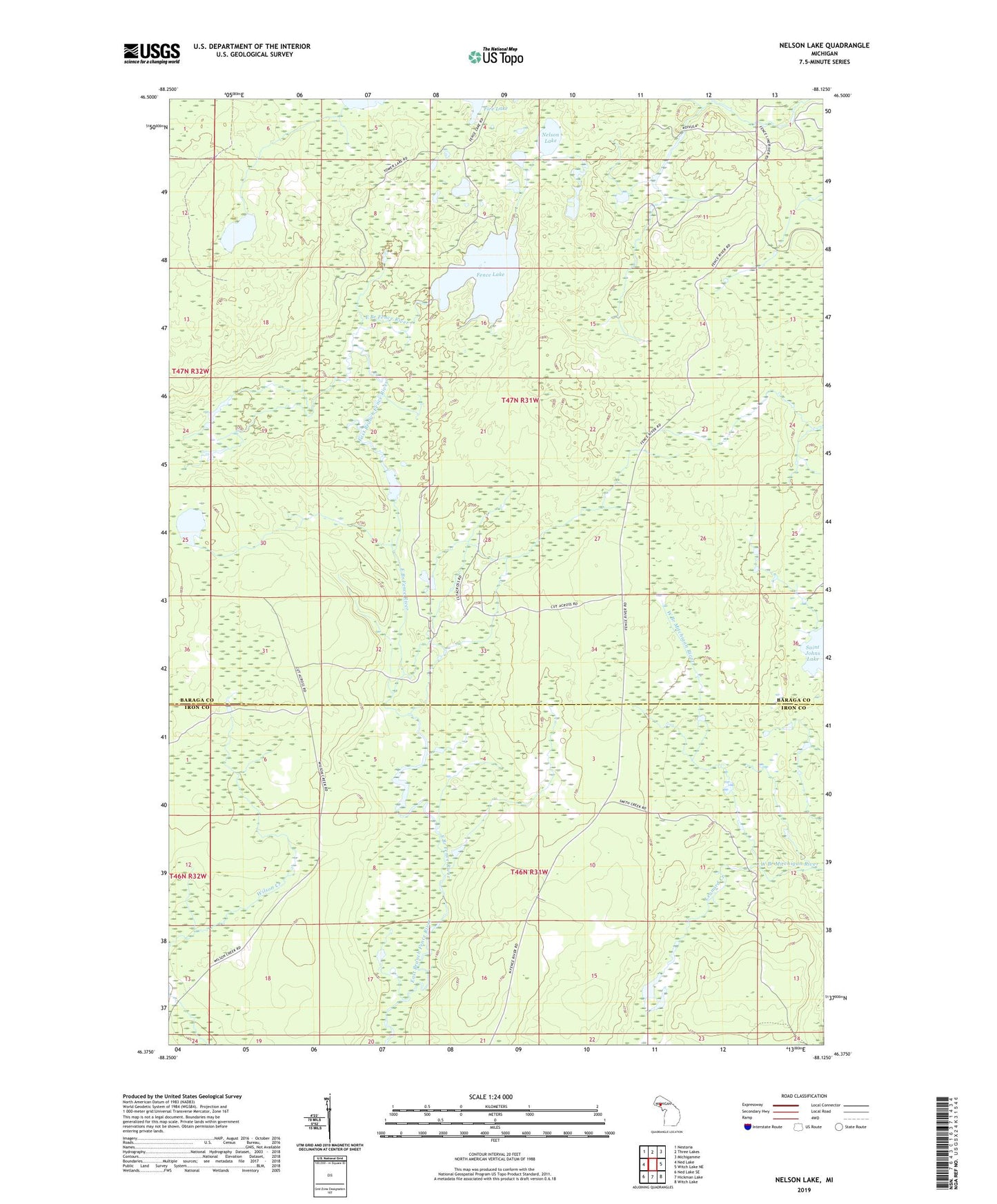
2023 topographic map quadrangle Nelson Lake in the state of Michigan. Scale: 1:24000. Based on the newly updated USGS 7.5' US Topo map series, this map is in the following counties: Baraga, Iron. The map contains contour data, water features, and other items you are used to seeing on USGS maps, but also has updated roads and other features. This is the next generation of topographic maps. Printed on high-quality waterproof paper with UV fade-resistant inks.
Quads adjacent to this one:
West: Ned Lake
Northwest: Nestoria
North: Three Lakes
Northeast: Michigamme
East: Witch Lake NE
Southeast: Witch Lake
South: Hickman Lake
Southwest: Ned Lake SE
This map covers the same area as the classic USGS quad with code o46088d2.
Contains the following named places: Fence Lake, Fire Lake, Leonard Creek, Nelson Lake, Nilegan Dam, Perry Lake, Tower Lake, West Branch Mitchigan River, ZIP Code: 49861